


Favourite
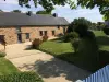
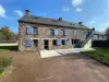
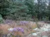
Paimpont forest


| Municipality | Concoret |
|---|---|
| Postcode | 56430 |
| Latitude | 48.0635670 (N 48° 3’ 49”) |
| Longitude | -2.2049340 (W 2° 12’ 18”) |
| Altitude | From 66m to 133m |
| Surface area | 15.76 km² |
| Population | 767 inhabitants |
| Density | 48 inhabitants/km² |
| Prefecture | Vannes (74 km, 1:03) |
| Insee code | 56043 |
| Intercommunality | CC Ploërmel Communauté |
| Department | Morbihan |
| Region | Brittany |
| Saint-Léry | 5.7 km (9 min) |
|---|---|
| Mauron | 6.5 km (7 min) |
| Paimpont | 7 km (8 min) |
| Saint-Malon-sur-Mel | 9.1 km (12 min) |
| Gaël | 9.4 km (9 min) |
| Bléruais | 9.9 km (13 min) |
| Tréhorenteuc | 10.8 km (12 min) |
| Saint-Brieuc-de-Mauron | 12.7 km (15 min) |
| Saint-Gonlay | 13 km (16 min) |
| Plélan-le-Grand | 13.1 km (13 min) |
| Muel | 13.6 km (13 min) |
| Beignon | 14.5 km (17 min) |
| Néant-sur-Yvel | 15.1 km (13 min) |
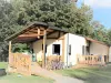
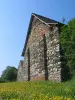
| Monuments |
|---|


| Last name | Activity type | Rate | City |
|---|---|---|---|
 | Nature and the great outdoors | 6 € to 9 € | Carentoir (30 km) |
| Last name | Outing type | Difficulty | Duration | Departure municipality |
|---|---|---|---|---|
 | Hike | Intermediate | 3:15 | Campénéac (8.9 km) |
 | All-terrain bike itinerary | Intermediate | 1:55 | Mauron (9.7 km) |
 | Hike | Intermediate | 4:45 | Guer (19.3 km) |
 | Hike | Easy | 3:30 | Guer (19.3 km) |
 | Hike | Intermediate | 4:10 | Ploërmel (20 km) |