


Favourite
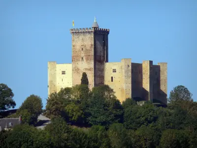
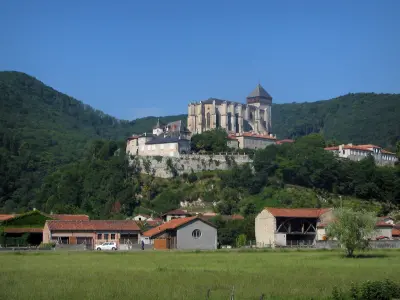
Mauvezin castle
| Municipality | Clarens |
|---|---|
| Postcode | 65300 |
| Latitude | 43.1633590 (N 43° 9’ 48”) |
| Longitude | 0.4145480 (E 0° 24’ 52”) |
| Altitude | From 406m to 602m |
| Surface area | 11.30 km² |
| Population | 520 inhabitants |
| Density | 46 inhabitants/km² |
| Prefecture | Tarbes (42 km, 42 min) |
| Insee code | 65150 |
| Intercommunality | CC du Plateau de Lannemezan |
| Department | Hautes-Pyrénées |
| Territories | Gascony, Midi-Pyrénées, Pyrenees |
| Region | Occitanie |
| Galez | 3.4 km (8 min) |
|---|---|
| Réjaumont | 5.2 km (12 min) |
| Lannemezan | 6.7 km (10 min) |
| Galan | 7.3 km (10 min) |
| Campistrous | 7.3 km (15 min) |
| Uglas | 7.4 km (12 min) |
| Pinas | 7.4 km (9 min) |
| Tajan | 7.8 km (14 min) |
| Cantaous | 9.2 km (14 min) |
| Monlong | 9.2 km (13 min) |
| Escala | 9.9 km (14 min) |
| Lagrange | 10.3 km (16 min) |
| Tournous-Devant | 10.4 km (14 min) |
| Recurt | 10.7 km (16 min) |
| Last name | Activity type | Rate | City |
|---|---|---|---|
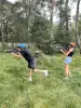 | Sports sensations | 15 € to 25 € | Lannemezan (6.9 km) |
 | Sports sensations | 39 € to 70 € | Bagnères-de-Bigorre (24 km) |
 | Sports sensations | 45 € | Campan (25 km) |
 | Nature and the great outdoors | 29 € to 65 € | Arreau (29 km) |
 | Sports sensations | 34 € | Campan (31 km) |
| Last name | Outing type | Difficulty | Duration | Departure municipality |
|---|---|---|---|---|
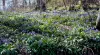 | Hike | Intermediate | 3:00 | Bize (14.2 km) |
 | Hike | Intermediate | 3:25 | Asté (23 km) |
 | All-terrain bike itinerary | Easy | 1:00 | Bagnères-de-Bigorre (24 km) |
 | Cycling itinerary | Intermediate | 3:20 | Bagnères-de-Bigorre (24 km) |
 | Cycling itinerary | Easy | 1:40 | Bagnères-de-Bigorre (24 km) |