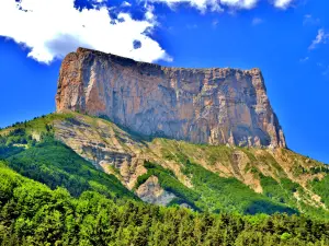
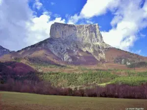
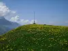
50 km from Grenoble, at the foot of Mont Aiguille, this town of about 280 inhabitants is a starting point for hiking grandiose.


Favourite


50 km from Grenoble, at the foot of Mont Aiguille, this town of about 280 inhabitants is a starting point for hiking grandiose.
| Municipality | Chichilianne |
|---|---|
| Postcode | 38930 |
| Latitude | 44.8121220 (N 44° 48’ 44”) |
| Longitude | 5.5735120 (E 5° 34’ 25”) |
| Altitude | From 798m to 2082m |
| Surface area | 62.48 km² |
| Population | 306 inhabitants |
| Density | 4 inhabitants/km² |
| Prefecture | Grenoble (55 km, 46 min) |
| Insee code | 38103 |
| Intercommunality | CC du Trièves |
| Department | Isère |
| Territories | Alps, Dauphiné |
| Region | Auvergne-Rhône-Alps |
| Clelles | 6.4 km (9 min) |
|---|---|
| Saint-Martin-de-Clelles | 8.8 km (13 min) |
| Le Percy | 10.9 km (14 min) |
| Monestier-du-Percy | 12.6 km (15 min) |
| Saint-Michel-les-Portes | 12.7 km (14 min) |
| Lavars | 14 km (19 min) |
| Saint-Maurice-en-Trièves | 15.9 km (17 min) |
| Prébois | 16.6 km (23 min) |
| Cornillon-en-Trièves | 17.1 km (24 min) |
| Lalley | 17.7 km (20 min) |
| Mens | 18.7 km (25 min) |
| Roissard | 18.8 km (24 min) |
| Monestier-de-Clermont | 20 km (22 min) |
| Saint-Paul-lès-Monestier | 23 km (26 min) |
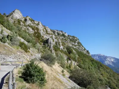
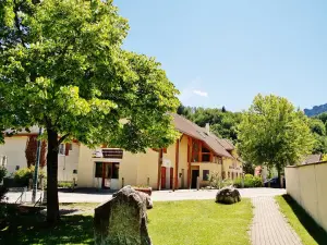
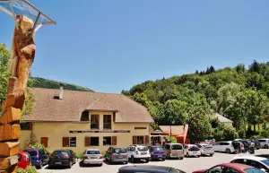
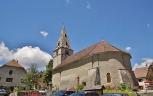
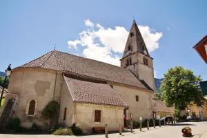
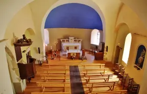
When we think Chichilianne we necessarily think of Mont Aiguille, majestic peak, and birthplace of mountaineering. Chichilianne but it is also a village rich in art and history : prehistoric traces, the Mecca of the Resistance, Roman quarries.... Chichilianne has a remarkable architectural heritage Ruthières Castle, Castle Passières Romanesque church...
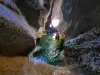
Trail craftsmen of the earth : " Discover the world of agriculture in mountain ", from the hamlet of Ruthière, 5 km loop, cumulative altitude : 170 m, educational booklet on sale at Information Relays Regional Natural Park of Vercors.
Trail Charenches " historic Discovery, economic, geological, flora and fauna " from the hamlet of Richardière, elevation : 594 m, topo sale Information Relays Regional Natural Park of Vercors.


| Last name | Activity type | Rate | City |
|---|---|---|---|
 | Culture and education | 17 € | Pont-en-Royans (33 km) |
 | Sports sensations | 45 € to 75 € | Autrans-Méaudre en Vercors (40 km) |
 | Sports sensations | 50 € to 80 € | Grenoble (44 km) |
 | Sports sensations | 48 € to 60 € | Grenoble (44 km) |
 | Sports sensations | 50 € to 65 € | Grenoble (44 km) |
| Last name | Outing type | Difficulty | Duration | Departure municipality |
|---|---|---|---|---|
 | Hike | Athletic | 7:30 | Monestier-du-Percy (7 km) |
 | Hike | Intermediate | 5:00 | Mens (14.1 km) |
 | Hike | Athletic | 4:40 | Château-Bernard (18.1 km) |
 | Hike | Easy | 1:00 | Ponet-et-Saint-Auban (20 km) |
 | Hike | Easy | 2:00 | La Chapelle-en-Vercors (21 km) |


