
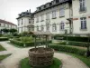

Favourite
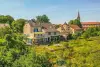
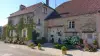
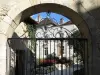
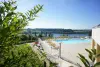
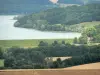
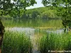
The Land of Four Lakes
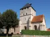
| Municipality | Champigny-lès-Langres |
|---|---|
| Postcode | 52200 |
| Latitude | 47.8933120 (N 47° 53’ 36”) |
| Longitude | 5.3460350 (E 5° 20’ 46”) |
| Surface area | 6.35 km² |
| Population | 422 inhabitants |
| Density | 66 inhabitants/km² |
| Prefecture | Chaumont (35 km, 35 min) |
| Insee code | 52102 |
| Intercommunality | CC du Grand Langres |
| Department | Haute-Marne |
| Territory | Champagne-Ardenne |
| Region | Great East |
| Humes-Jorquenay | 3.4 km (5 min) |
|---|---|
| Charmes | 3.5 km (7 min) |
| Peigney | 3.8 km (7 min) |
| Langres | 4.5 km (8 min) |
| Changey | 6.2 km (10 min) |
| Bannes | 7 km (8 min) |
| Chanoy | 8.1 km (12 min) |
| Saints-Geosmes | 8.7 km (12 min) |
| Perrancey-les-Vieux-Moulins | 8.9 km (12 min) |
| Rolampont | 9.6 km (14 min) |
| Dampierre | 9.9 km (17 min) |
| Saint-Vallier-sur-Marne | 10.8 km (13 min) |
| Chatenay-Mâcheron | 11.1 km (13 min) |
| Last name | Outing type | Difficulty | Duration | Departure municipality |
|---|---|---|---|---|
 | Hike | Intermediate | 5:20 | Champigny-lès-Langres |
 | Cycling itinerary | Easy | 1:50 | Peigney (2.5 km) |
 | Cycling itinerary | Easy | 50 min | Langres (2.9 km) |
 | Hike | Easy | 3:00 | Langres (3.5 km) |
 | Hike | Athletic | 6:05 | Humes-Jorquenay (3.5 km) |