Favourite
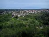
La Souterraine
| Municipality | Chamborand |
|---|---|
| Postcode | 23240 |
| Latitude | 46.1563280 (N 46° 9’ 23”) |
| Longitude | 1.5722570 (E 1° 34’ 20”) |
| Altitude | From 340m to 479m |
| Surface area | 11.18 km² |
| Population | 245 inhabitants |
| Density | 21 inhabitants/km² |
| Prefecture | Guéret (26 km, 30 min) |
| Insee code | 23047 |
| Intercommunality | CC de Bénévent Grand Bourg |
| Department | Creuse |
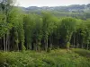
| Territories | Limousin, Massif Central |
| Region | New-Aquitaine |
| Fursac | 5.4 km (7 min) |
|---|---|
| Le Grand-Bourg | 6.2 km (8 min) |
| Bénévent-l'Abbaye | 6.9 km (10 min) |
| Saint-Priest-la-Feuille | 7 km (11 min) |
| Lizières | 8.1 km (13 min) |
| Marsac | 9.6 km (15 min) |
| Saint-Priest-la-Plaine | 10.1 km (12 min) |
| Noth | 11.1 km (19 min) |
| Mourioux-Vieilleville | 12.2 km (17 min) |
| Arrènes | 12.6 km (20 min) |
| Folles | 14 km (19 min) |
| Gartempe | 14.5 km (20 min) |
| Ceyroux | 14.6 km (20 min) |
| Laurière | 15.4 km (18 min) |
| Last name | Outing type | Difficulty | Duration | Departure municipality |
|---|---|---|---|---|
 | Hike | Easy | 4:00 | Saint-Léger-la-Montagne (18.4 km) |
 | Hike | Easy | 6:00 | Razès (23 km) |
 | Car itinerary | Easy | 45 min | Saint-Sébastien (26 km) |
 | Hike | Easy | 1:30 | Bourganeuf (27 km) |
 | Village visit | Easy | 3:00 | Soubrebost (30 km) |