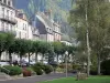
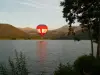
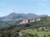
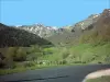
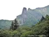
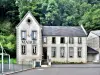
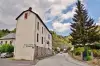
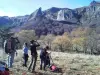
Small mountain community located 40 miles southwest of Clermont-Ferrand, nestled 880 meters above sea level at the foot of the Massif du Sancy (1886 m).


Favourite


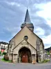
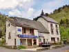
Small mountain community located 40 miles southwest of Clermont-Ferrand, nestled 880 meters above sea level at the foot of the Massif du Sancy (1886 m).
| Municipality | Chambon-sur-Lac |
|---|---|
| Postcode | 63790 |
| Tourism labels |     |
| Latitude | 45.5706440 (N 45° 34’ 14”) |
| Longitude | 2.8956110 (E 2° 53’ 44”) |
| Altitude | From 873m to 1883m |
| Surface area | 46.93 km² |
| Population | 431 inhabitants |
| Density | 9 inhabitants/km² |
| Prefecture | Clermont-Ferrand (39 km, 43 min) |
| Insee code | 63077 |
| Intercommunality | CC du Massif du Sancy |
| Department | Puy-de-Dôme |
| Territories | Auvergne, Massif Central |
| Region | Auvergne-Rhône-Alps |
| Murol | 4.3 km (8 min) |
|---|---|
| Saint-Victor-la-Rivière | 7.6 km (12 min) |
| Saint-Nectaire | 9.7 km (15 min) |
| Le Vernet-Sainte-Marguerite | 10.1 km (13 min) |
| Saint-Diéry | 13.1 km (19 min) |
| Verrières | 14 km (20 min) |
| Besse-et-Saint-Anastaise | 14.1 km (18 min) |
| Saulzet-le-Froid | 15.7 km (19 min) |
| Mont-Dore | 15.9 km (20 min) |
| Grandeyrolles | 17.5 km (26 min) |
| Saurier | 17.6 km (26 min) |
| Aydat | 18.1 km (22 min) |
| Saint-Pierre-Colamine | 18.2 km (23 min) |
| Montaigut-le-Blanc | 19 km (24 min) |
| Courgoul | 19.4 km (27 min) |
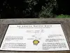
| Information points | |
|---|---|
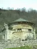
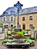
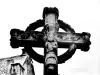
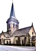
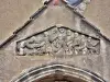
| Monuments | |
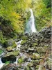
| Natural sites |


| Last name | Activity type | Rate | City |
|---|---|---|---|
 | Sports sensations | 20 € | Lanobre (33 km) |
 | Nature and the great outdoors | 140 € to 240 € | Volvic (35 km) |
 | Nature and the great outdoors | 7 € | Chapdes-Beaufort (36 km) |
 | Well-being | 87 € to 170 € | Lezoux (46 km) |
| Last name | Outing type | Difficulty | Duration | Departure municipality |
|---|---|---|---|---|
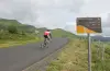 | Cycling itinerary | Athletic | 35 min | Mont-Dore (6 km) |
 | Hike | Easy | 45 min | Besse-et-Saint-Anastaise (7.1 km) |
 | Hike | Easy | 20 min | Besse-et-Saint-Anastaise (7.1 km) |
 | Motorbike itinerary | Intermediate | 1:40 | Besse-et-Saint-Anastaise (7.2 km) |
 | Hike | Intermediate | 1:00 | Besse-et-Saint-Anastaise (8 km) |