

Favourite
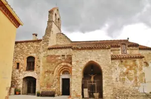
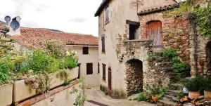
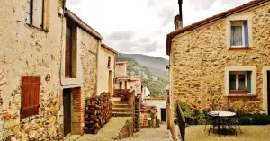
Castelnou


| Municipality | Calmeilles |
|---|---|
| Postcode | 66400 |
| Latitude | 42.5521529 (N 42° 33’ 8”) |
| Longitude | 2.6751640 (E 2° 40’ 31”) |
| Altitude | From 256m to 784m |
| Surface area | 13.22 km² |
| Population | 62 inhabitants |
| Density | 4 inhabitants/km² |
| Prefecture | Perpignan (45 km, 44 min) |
| Insee code | 66032 |
| Intercommunality | CC des Aspres |
| Department | Pyrénées-Orientales |
| Territories | Languedoc-Roussillon, Pyrenees |
| Region | Occitanie |
| Oms | 3.9 km (7 min) |
|---|---|
| Prunet-et-Belpuig | 5.3 km (10 min) |
| Taillet | 5.8 km (10 min) |
| Caixas | 6.5 km (23 min) |
| Boule-d'Amont | 8.7 km (14 min) |
| Llauro | 9.7 km (18 min) |
| Montauriol | 10.2 km (21 min) |
| Saint-Marsal | 10.9 km (16 min) |
| Tordères | 12.2 km (22 min) |
| Vivès | 14.6 km (25 min) |
| Fourques | 15.4 km (25 min) |
| La Bastide | 16.3 km (25 min) |
| Castelnou | 17.2 km (40 min) |
| Céret | 17.5 km (29 min) |
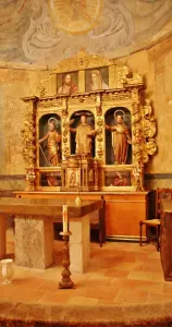
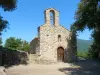
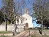
| Monuments |
|---|


| Last name | Activity type | Rate | City |
|---|---|---|---|
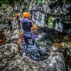 | Sports sensations | 35 € | Céret (10.3 km) |
 | Sports sensations | 250 € to 300 € | Le Soler (17.9 km) |
 | Sports sensations | 44 € to 64 € | Prades (21 km) |
 | Sports sensations | 72 € to 112 € | Baixas (25 km) |
 | Nature and the great outdoors | 6 € to 12 € | Villefranche-de-Conflent (26 km) |
| Last name | Outing type | Difficulty | Duration | Departure municipality |
|---|---|---|---|---|
 | Hike | Intermediate | 2:00 | Amélie-les-Bains-Palalda (7.6 km) |
 | Hike | Intermediate | 3:30 | Amélie-les-Bains-Palalda (7.6 km) |
 | Hike | Easy | 1:00 | Amélie-les-Bains-Palalda (8.8 km) |
 | Hike | Easy | 2:10 | Céret (9.5 km) |
 | Hike | Easy | 1:50 | Le Boulou (13.3 km) |