


Favourite
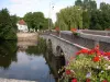
Château-Guillaume
| Municipality | Bonneuil |
|---|---|
| Postcode | 36310 |
| Latitude | 46.3726640 (N 46° 22’ 22”) |
| Longitude | 1.2252110 (E 1° 13’ 31”) |
| Altitude | From 160m to 234m |
| Surface area | 11.41 km² |
| Population | 74 inhabitants |
| Density | 6 inhabitants/km² |
| Prefecture | Châteauroux (74 km, 1:03) |
| Insee code | 36020 |
| Intercommunality | CC Marche Occitane - Val d'Anglin |
| Department | Indre |
| Territory | Berry |
| Region | Centre-Loire Valley |
| Saint-Martin-le-Mault | 1.6 km (2 min) |
|---|---|
| Tilly | 4.5 km (8 min) |
| Jouac | 5.8 km (9 min) |
| Lussac-les-Églises | 5.9 km (9 min) |
| Beaulieu | 7.3 km (11 min) |
| Chaillac | 9.4 km (14 min) |
| Coulonges | 9.4 km (14 min) |
| Verneuil-Moustiers | 9.7 km (14 min) |
| Cromac | 9.9 km (15 min) |
| Thollet | 12.3 km (17 min) |
| Mailhac-sur-Benaize | 12.8 km (16 min) |
| Lignac | 13 km (18 min) |
| Dunet | 13.4 km (21 min) |
| Saint-Georges-les-Landes | 13.5 km (17 min) |
| Last name | Outing type | Difficulty | Duration | Departure municipality |
|---|---|---|---|---|
 | Hike | Easy | 2:30 | Thollet (11.3 km) |
 | Car itinerary | Easy | 1:00 | La Trimouille (17.6 km) |
 | Car itinerary | Easy | 1:00 | La Trimouille (17.6 km) |
 | Hike | Intermediate | 1:45 | La Trimouille (17.6 km) |
 | Hike | Easy | 4:05 | Journet (23 km) |