
Favourite
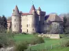
Massiac
| Municipality | Bonnac |
|---|---|
| Postcode | 15500 |
| Latitude | 45.2081960 (N 45° 12’ 30”) |
| Longitude | 3.1588860 (E 3° 9’ 32”) |
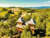
| Altitude | From 560m to 1007m |
| Surface area | 22.60 km² |
| Population | 167 inhabitants |
| Density | 7 inhabitants/km² |
| Prefecture | Aurillac (90 km, 1:27) |
| Insee code | 15022 |
| Intercommunality | CC Hautes Terres Communauté |
| Department | Cantal |
| Territories | Auvergne, Massif Central |
| Region | Auvergne-Rhône-Alps |
| Saint-Mary-le-Plain | 3.8 km (6 min) |
|---|---|
| Massiac | 7 km (11 min) |
| Saint-Poncy | 8 km (16 min) |
| Grenier-Montgon | 10.9 km (15 min) |
| Vieillespesse | 11.5 km (17 min) |
| Molompize | 12.5 km (14 min) |
| La Chapelle-Laurent | 13.9 km (22 min) |
| Espalem | 14.6 km (18 min) |
| Lubilhac | 15.1 km (23 min) |
| Blesle | 15.4 km (20 min) |
| Rézentières | 15.7 km (22 min) |
| Lastic | 16.6 km (24 min) |
| Saint-Beauzire | 17.1 km (19 min) |
| Charmensac | 17.8 km (23 min) |
| Last name | Activity type | Rate | City |
|---|---|---|---|
 | Sports sensations | 50 € to 350 € | Coltines (19.8 km) |
 | Sports sensations | 50 € to 60 € | Vieille-Brioude (21 km) |
 | Nature and the great outdoors | 40 € to 75 € | Albepierre-Bredons (29 km) |
| Last name | Outing type | Difficulty | Duration | Departure municipality |
|---|---|---|---|---|
 | Hike | Easy | 2:00 | Champagnac-le-Vieux (32 km) |
 | Hike | Intermediate | 3:05 | Saint-Jacques-des-Blats (36 km) |
 | Motorbike itinerary | Intermediate | 1:40 | Besse-et-Saint-Anastaise (38 km) |
 | Hike | Easy | 20 min | Besse-et-Saint-Anastaise (38 km) |
 | Hike | Easy | 45 min | Besse-et-Saint-Anastaise (38 km) |