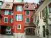
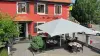
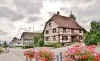
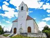
Liven up your holidays!

Bettlach

Tourism, holidays & weekends guide in the Haut-Rhin

Bettlach - Tourism, holidays & weekends guide in the Haut-Rhin
7.3
3

Geographical information

MunicipalityBettlach
Postcode68480
Latitude47.5088200 (N 47° 30’ 32”)
Longitude7.4135720 (E 7° 24’ 49”)
AltitudeFrom 399m to 530m
Surface area4.09 km²
Population325 inhabitants
Density79 inhabitants/km²
PrefectureColmar (75 km, 57 min)
Insee code68034
IntercommunalityCC Sundgau
DepartmentHaut-Rhin
TerritoryAlsace
RegionGreat East

Nearest cities & towns

Linsdorf1.3 km (4 min)
Oltingue2.6 km (4 min)
Fislis4.1 km (7 min)
Hagenthal-le-Haut5.2 km (9 min)
Werentzhouse5.4 km (7 min)
Muespach5.6 km (10 min)
Muespach-le-Haut5.6 km (10 min)
Lutter5.9 km (9 min)
Hagenthal-le-Bas6.1 km (9 min)
Raedersdorf6.2 km (9 min)
Wolschwiller6.3 km (10 min)
Liebenswiller6.4 km (9 min)
Folgensbourg6.5 km (9 min)
Bouxwiller7 km (8 min)

Photos

The town
The town
See photo
Street Basel Bettlach (© J.E)
See photo
The Church of St. Blaise (© J.E)
See photo
the town
the town
See photo
Fountain
Fountain
See photo
the town
the town
See photo
The town hall
The town hall
See photo
the town
the town
See photo
The Church of St. Blaise
See photo
The Church of St. Blaise
See photo
The Church of St. Blaise
See photo
The Church of St. Blaise (© J.E)
See photo
Fountain, near the town hall (© J.E)
See photo
Lintel, dated 1732-1952 - Hamlet of St. Blaise (© J.E)
See photo
Hall School of Bettlach (© J.E)
See photo

Weather

Thursday 25 april
Min. 2°C - Max. 8°C
Day
Night
Friday 26 april
Min. 4°C - Max. 12°C
Day
Night
Saturday 27 april
Min. 7°C - Max. 18°C
Day
Night

Visits, leisure and activities nearby

Outings

Last nameOuting typeDifficultyDurationDeparture municipality
Rangen massif
HikeIntermediate1:00Burnhaupt-le-Haut (32 km)
The Rangen massif
HikeIntermediate1:05Thann (41 km)
Tour of the historic centre
Village visitEasy1:00Masevaux-Niederbruck (43 km)
Sattelboden Chalet
HikeIntermediate3:00Masevaux-Niederbruck (43 km)
Walk to Fort Lachaux- Grand-Charmont, Sochaux, Montbéliard
HikeIntermediate35 minGrand-Charmont (44 km)

Restaurants

Bed & breakfasts

Vacation rentals

Campsites

Hotels

Your holidays
A hotel
A vacation rental
A bed & breakfast
A campsite
A leisure activity
A restaurant
A rental car
A plane ticket
By continuing to browse our site, you are agreeing to the use of cookies to improve your experience and make targeted offers.
Find out more and make settings
Your account