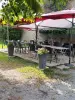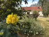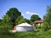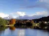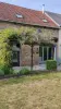


Favourite
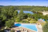
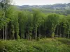
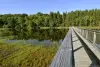
The Chabrières forest
| Municipality | Azat-Châtenet |
|---|---|
| Postcode | 23210 |
| Latitude | 46.0776880 (N 46° 4’ 40”) |
| Longitude | 1.7612840 (E 1° 45’ 41”) |
| Altitude | From 436m to 565m |
| Surface area | 9.51 km² |
| Population | 125 inhabitants |
| Density | 13 inhabitants/km² |
| Prefecture | Guéret (17.1 km, 24 min) |
| Insee code | 23014 |
| Intercommunality | CC de Bénévent Grand Bourg |
| Department | Creuse |
| Territories | Limousin, Massif Central |
| Region | New-Aquitaine |
| Janaillat | 3.3 km (6 min) |
|---|---|
| Augères | 3.9 km (6 min) |
| Montaigut-le-Blanc | 6.4 km (9 min) |
| Saint-Éloi | 7.7 km (12 min) |
| Saint-Dizier-Masbaraud | 8.4 km (15 min) |
| Aulon | 8.8 km (13 min) |
| Saint-Victor-en-Marche | 10 km (17 min) |
| Saint-Silvain-Montaigut | 10 km (14 min) |
| Gartempe | 10.3 km (14 min) |
| La Chapelle-Taillefert | 10.8 km (16 min) |
| Bosmoreau-les-Mines | 12.1 km (19 min) |
| Saint-Christophe | 12.4 km (18 min) |
| Ceyroux | 12.5 km (20 min) |
| Mourioux-Vieilleville | 13.7 km (22 min) |
| Last name | Outing type | Difficulty | Duration | Departure municipality |
|---|---|---|---|---|
 | Hike | Easy | 1:30 | Bourganeuf (13.8 km) |
 | Village visit | Easy | 3:00 | Soubrebost (14.7 km) |
 | Car itinerary | Easy | 1:00 | Ahun (22 km) |
 | Hike | Easy | 4:00 | Saint-Léger-la-Montagne (27 km) |
 | Village visit | Athletic | 6:00 | Peyrat-le-Château (31 km) |