
Favourite
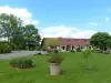
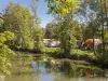
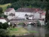
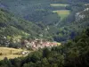
Saint-Hippolyte


| Municipality | Autechaux-Roide |
|---|---|
| Postcode | 25150 |
| Latitude | 47.3917820 (N 47° 23’ 30”) |
| Longitude | 6.8155180 (E 6° 48’ 56”) |
| Altitude | From 363m to 575m |
| Surface area | 6.56 km² |
| Population | 526 inhabitants |
| Density | 80 inhabitants/km² |
| Prefecture | Besançon (88 km, 1:06) |
| Insee code | 25033 |
| Intercommunality | CA Pays de Montbéliard Agglomération |
| Department | Doubs |
| Territories | Franche-Comté, Jura mountains |
| Region | Burgundy-Franche-Comté |
| Écurcey | 2.1 km (5 min) |
|---|---|
| Roches-lès-Blamont | 4.1 km (7 min) |
| Pont-de-Roide-Vermondans | 4.3 km (7 min) |
| Thulay | 5.8 km (9 min) |
| Blamont | 5.9 km (9 min) |
| Pierrefontaine-lès-Blamont | 6.3 km (11 min) |
| Bondeval | 7.2 km (8 min) |
| Bourguignon | 8 km (11 min) |
| Mandeure | 8.1 km (15 min) |
| Noirefontaine | 8.2 km (10 min) |
| Villars-sous-Dampjoux | 8.9 km (11 min) |
| Villars-lès-Blamont | 9.1 km (13 min) |
| Hérimoncourt | 9.1 km (13 min) |
| Seloncourt | 9.5 km (12 min) |


| Last name | Outing type | Difficulty | Duration | Departure municipality |
|---|---|---|---|---|
 | Hike | Intermediate | 35 min | Grand-Charmont (14.3 km) |
 | Hike | Easy | 1:00 | Pays-de-Clerval (24 km) |
 | Village visit | Easy | 1:00 | Masevaux-Niederbruck (45 km) |
 | Hike | Intermediate | 3:00 | Masevaux-Niederbruck (45 km) |
 | Hike | Intermediate | 1:00 | Burnhaupt-le-Haut (45 km) |