

Favourite
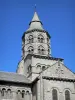
Orcival basilica


| Municipality | Aurières |
|---|---|
| Postcode | 63210 |
| Latitude | 45.6839240 (N 45° 41’ 2”) |
| Longitude | 2.9058980 (E 2° 54’ 21”) |
| Altitude | From 878m to 1074m |
| Surface area | 11.09 km² |
| Population | 382 inhabitants |
| Density | 34 inhabitants/km² |
| Prefecture | Clermont-Ferrand (23 km, 31 min) |
| Insee code | 63020 |
| Intercommunality | CC Dômes Sancy Artense |
| Department | Puy-de-Dôme |
| Territories | Auvergne, Massif Central |
| Region | Auvergne-Rhône-Alps |
| Vernines | 3.5 km (6 min) |
|---|---|
| Nébouzat | 6.6 km (8 min) |
| Saulzet-le-Froid | 9.6 km (12 min) |
| Aydat | 10.6 km (14 min) |
| Olby | 10.7 km (10 min) |
| Orcival | 10.8 km (17 min) |
| Saint-Bonnet-près-Orcival | 11.6 km (12 min) |
| Saint-Genès-Champanelle | 11.9 km (13 min) |
| Rochefort-Montagne | 12.9 km (20 min) |
| Saint-Pierre-Roche | 14.2 km (15 min) |
| Ceyssat | 14.5 km (16 min) |
| Cournols | 14.9 km (20 min) |
| Le Vernet-Sainte-Marguerite | 15.7 km (17 min) |
| Mazaye | 17 km (21 min) |
| Last name | Activity type | Rate | City |
|---|---|---|---|
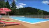
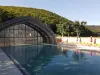
 | Nature and the great outdoors | 140 € to 240 € | Volvic (23 km) |
 | Nature and the great outdoors | 7 € | Chapdes-Beaufort (23 km) |
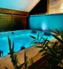
 | Well-being | 87 € to 170 € | Lezoux (39 km) |
 | Sports sensations | 20 € | Lanobre (41 km) |
| Last name | Outing type | Difficulty | Duration | Departure municipality |
|---|---|---|---|---|
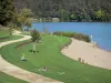
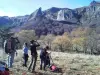
 | Hike | Intermediate | 1:05 | Aydat (3 km) |
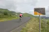 | Cycling itinerary | Athletic | 35 min | Mont-Dore (14.3 km) |
 | Cycling itinerary | Intermediate | 20 min | Murat-le-Quaire (14.8 km) |
 | Hike | Easy | 45 min | Besse-et-Saint-Anastaise (19.2 km) |
 | Hike | Easy | 20 min | Besse-et-Saint-Anastaise (19.2 km) |