Liven up your holidays!

Aulan

Tourism, holidays & weekends guide in the Drôme

Geographical information

MunicipalityAulan
Postcode26570
Latitude44.2222870 (N 44° 13’ 20”)
Longitude5.4280910 (E 5° 25’ 41”)
AltitudeFrom 720m to 1122m
Surface area10.55 km²
Population10 inhabitants
PrefectureValence (156 km, 2:07)
Insee code26018
IntercommunalityCC des Baronnies en Drôme Provençale
DepartmentDrôme
TerritoriesDauphiné, Drôme-Ardèche
RegionAuvergne-Rhône-Alps

Nearest cities & towns

La Rochette-du-Buis6.9 km (10 min)
Mévouillon7.1 km (12 min)
Montbrun-les-Bains7.9 km (13 min)
Reilhanette8.3 km (12 min)
Saint-Auban-sur-l'Ouvèze10.6 km (16 min)
Villefranche-le-Château12.1 km (18 min)
Savoillan13.1 km (19 min)
La Roche-sur-le-Buis13.3 km (27 min)
Aurel14.4 km (21 min)
Montguers14.9 km (21 min)
Sainte-Euphémie-sur-Ouvèze15.4 km (23 min)
Barret-de-Lioure15.4 km (23 min)
Rioms15.6 km (27 min)

Things to see and do

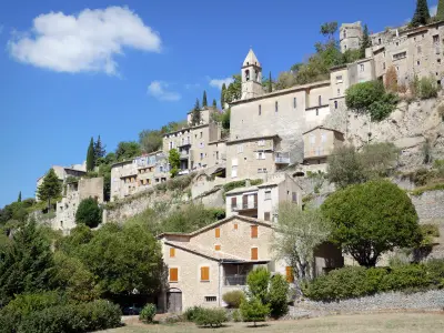
This is the 12th century that Mévouillon decide to build a castle Aulan in the Baron, to block access to their land from the south. Burned during the Revolution, it was rebuilt in the 19th and current architecture mainly dates from this period. It is open to visitors in summer, from 10am to 12am in the morning and from 14 to 18:30 at night.

Places of interest

Monuments

Weather

Wednesday 24 april
Min. 2°C - Max. 10°C
Day
Night
Thursday 25 april
Min. 1°C - Max. 11°C
Day
Night
Friday 26 april
Min. 3°C - Max. 9°C
Day
Night

Visits, leisure and activities nearby

Leisure activities

Last nameActivity typeRateCity
Visit a lavender distillery
Local flavoursFreeSault (12.7 km)
Tour of a lavender distillery
Well-beingFreeSault (13.6 km)
Donkey trek in Hautes Alpes
Nature and the great outdoors50 € to 375 € Éourres (22 km)
Easy ceramics class
Arts and Crafts30 € Saint-Vincent-sur-Jabron (26 km)
Bike hire at the foot of Mount Ventoux
Sports sensations45 € to 55 € Mormoiron (26 km)

Outings

Last nameOuting typeDifficultyDurationDeparture municipality
Défends Wood
HikeEasy2:20Sault (14.6 km)
Lavender Path
HikeEasy1:40Sault (14.6 km)
From Montfroc to Les Omergues
HikeEasy1:00Montfroc (18.1 km)
Olive Tree Trail
HikeEasy1:30Nyons (28 km)
Colorado of Provence
HikeEasy1:00Rustrel (33 km)

Restaurants

Bed & breakfasts

Vacation rentals

Campsites

Hotels

Your holidays
A hotel
A vacation rental
A bed & breakfast
A campsite
A leisure activity
A restaurant
A rental car
A plane ticket
By continuing to browse our site, you are agreeing to the use of cookies to improve your experience and make targeted offers.
Find out more and make settings
Your account