
Favourite
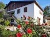
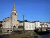
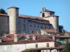
Ariège Pyrenees Regional Nature Park
| Municipality | Alos |
|---|---|
| Postcode | 09200 |
| Latitude | 42.9080830 (N 42° 54’ 29”) |
| Longitude | 1.1451000 (E 1° 8’ 42”) |
| Altitude | From 553m to 1874m |
| Surface area | 24.26 km² |
| Population | 122 inhabitants |
| Density | 5 inhabitants/km² |
| Prefecture | Foix (55 km, 58 min) |
| Insee code | 09008 |
| Intercommunality | CC Couserans-Pyrénées |
| Department | Ariège |
| Territories | Midi-Pyrénées, Pyrenees |
| Region | Occitanie |
| Sentenac-d'Oust | 7.6 km (12 min) |
|---|---|
| Lacourt | 7.6 km (12 min) |
| Erp | 10.2 km (18 min) |
| Eycheil | 10.6 km (15 min) |
| Seix | 10.6 km (18 min) |
| Encourtiech | 10.9 km (17 min) |
| Saint-Girons | 12.8 km (18 min) |
| Moulis | 12.9 km (21 min) |
| Rivèrenert | 13.2 km (19 min) |
| Engomer | 14.2 km (24 min) |
| Soueix-Rogalle | 14.2 km (19 min) |
| Saint-Lizier | 15.2 km (22 min) |
| Montjoie-en-Couserans | 15.2 km (22 min) |
| Oust | 15.9 km (20 min) |
| Last name | Activity type | Rate | City |
|---|---|---|---|
 | Nature and the great outdoors | 75 € to 576 € | Camarade (23 km) |
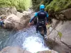 | Sports sensations | 35 € to 60 € | Bagnères-de-Luchon (47 km) |
| Last name | Outing type | Difficulty | Duration | Departure municipality |
|---|---|---|---|---|
 | Village visit | Easy | 4:00 | Galey (19 km) |
 | Hike | Easy | 4:00 | La Bastide-de-Sérou (26 km) |
| Village visit | Intermediate | 2:00 | Carbonne (43 km) |
 | Hike | Intermediate | 3:00 | Bize (57 km) |