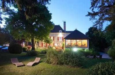
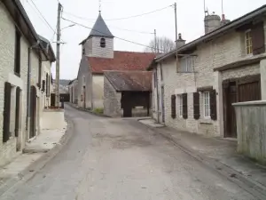
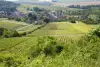
Municipality located at the foot of the vineyards and the coastal road from Champagne, bordered by the river Aube.


Favourite


Municipality located at the foot of the vineyards and the coastal road from Champagne, bordered by the river Aube.
| Municipality | Ailleville |
|---|---|
| Postcode | 10200 |
| Latitude | 48.2529770 (N 48° 15’ 11”) |
| Longitude | 4.6817630 (E 4° 40’ 54”) |
| Surface area | 5.01 km² |
| Population | 237 inhabitants |
| Density | 47 inhabitants/km² |
| Prefecture | Troyes (51 km, 53 min) |
| Insee code | 10002 |
| Intercommunality | CC de la Région de Bar-sur-Aube |
| Department | Aube |
| Territory | Champagne-Ardenne |
| Region | Great East |
| Montier-en-l'Isle | 2.1 km (3 min) |
|---|---|
| Arsonval | 3.1 km (3 min) |
| Bar-sur-Aube | 3.4 km (6 min) |
| Proverville | 4.3 km (7 min) |
| Jaucourt | 4.3 km (5 min) |
| Fontaine | 6 km (10 min) |
| Dolancourt | 6.7 km (8 min) |
| Bossancourt | 7.2 km (8 min) |
| Arrentières | 7.3 km (11 min) |
| Argançon | 8.2 km (10 min) |
| Éclance | 8.4 km (11 min) |
| Engente | 8.7 km (13 min) |
| Baroville | 9.3 km (14 min) |


The lakes of the Orient forest and port Dienville.
Troyes, the outlet stores.
The cellars of Champagne.
The Royal Crystal Champagne to Bayel.
The Memorial of General de Gaulle in Colombey-les-deux-Eglises.
| Last name | Activity type | Rate | City |
|---|---|---|---|
 | Entertainment | 30 € to 40 € | Ville-sur-Arce (24 km) |
| Last name | Outing type | Difficulty | Duration | Departure municipality |
|---|---|---|---|---|
 | Hike | Easy | 6:10 | Bar-sur-Aube (2.9 km) |
 | All-terrain bike itinerary | Athletic | 4:20 | Bar-sur-Aube (2.9 km) |
 | Hike | Easy | 2:25 | Colombé-la-Fosse (7.9 km) |
 | All-terrain bike itinerary | Athletic | 3:55 | Bayel (9.5 km) |
 | Hike | Easy | 3:55 | La Rothière (13.5 km) |