

Favourite
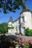
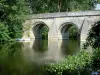
Parthenay
| Municipality | Adilly |
|---|---|
| Postcode | 79200 |
| Latitude | 46.6909890 (N 46° 41’ 28”) |
| Longitude | -0.3118560 (W 0° 18’ 43”) |
| Altitude | From 143m to 221m |
| Surface area | 12.92 km² |
| Population | 319 inhabitants |
| Density | 24 inhabitants/km² |
| Prefecture | Niort (50 km, 51 min) |
| Insee code | 79002 |
| Intercommunality | CC de Parthenay-Gâtine |
| Department | Deux-Sèvres |
| Territory | Poitou |
| Region | New-Aquitaine |
| Fénery | 4.2 km (6 min) |
|---|---|
| Saint-Germain-de-Longue-Chaume | 5.8 km (7 min) |
| Lageon | 7.9 km (13 min) |
| Amailloux | 8.1 km (10 min) |
| Saint-Aubin-le-Cloud | 8.8 km (12 min) |
| Châtillon-sur-Thouet | 8.9 km (11 min) |
| Parthenay | 9.4 km (12 min) |
| Clessé | 10.3 km (10 min) |
| Le Tallud | 10.6 km (12 min) |
| Pougne-Hérisson | 10.8 km (18 min) |
| Viennay | 11.1 km (14 min) |
| Azay-sur-Thouet | 12.1 km (16 min) |
| Neuvy-Bouin | 12.7 km (19 min) |
| Pompaire | 12.7 km (14 min) |
| Last name | Outing type | Difficulty | Duration | Departure municipality |
|---|---|---|---|---|
 | Hike | Intermediate | 3:45 | Saint-Michel-le-Cloucq (41 km) |
| Hike | Easy | 3:00 | Mouterre-Silly (42 km) |
 | Hike | Easy | 2:00 | Ternay (44 km) |
| Hike | Easy | 1:30 | Les Epesses (50 km) |
 | Hike | Easy | 1:05 | La Taillée (59 km) |