
Favourite
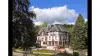
Domfront
| Municipality | Le Châtellier |
|---|---|
| Postcode | 61450 |
| Latitude | 48.6764719 (N 48° 40’ 35”) |
| Longitude | -0.5817240 (W 0° 34’ 54”) |
| Altitude | From 175m to 275m |
| Surface area | 8.18 km² |
| Population | 413 inhabitants |
| Density | 50 inhabitants/km² |
| Prefecture | Alençon (66 km, 1:10) |
| Insee code | 61102 |
| Intercommunality | CA Flers Agglo |
| Department | Orne |
| Territory | Perche |
| Region | Normandy |
| Banvou | 3.2 km (6 min) |
|---|---|
| Saint-Clair-de-Halouze | 3.9 km (8 min) |
| La Chapelle-au-Moine | 4 km (4 min) |
| La Ferrière-aux-Étangs | 5.7 km (10 min) |
| Messei | 5.9 km (9 min) |
| La Chapelle-Biche | 6.2 km (9 min) |
| Dompierre | 7.2 km (12 min) |
| Saint-Bômer-les-Forges | 7.3 km (11 min) |
| Saires-la-Verrerie | 7.9 km (11 min) |
| Saint-André-de-Messei | 8.4 km (10 min) |
| La Selle-la-Forge | 9.5 km (10 min) |
| Chanu | 10.1 km (13 min) |
| Flers | 10.2 km (14 min) |
| Échalou | 10.3 km (15 min) |
| Last name | Activity type | Rate | City |
|---|---|---|---|
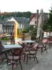
 | Well-being | 60 € to 150 € | Bagnoles de l'Orne Normandie (18 km) |
 | Entertainment | 23 € to 84 € | Saint-Pierre-du-Regard (19.7 km) |
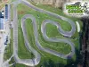 | Sports sensations | 16 € to 24 € | Le Neufbourg (27 km) |
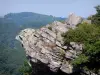
 | Nature and the great outdoors | 8 € | Thury-Harcourt-le-Hom (35 km) |
| Last name | Outing type | Difficulty | Duration | Departure municipality |
|---|---|---|---|---|
 | Car itinerary | Easy | 4:00 | Saint-Cyr-du-Bailleul (20 km) |
 | Cycling itinerary | Intermediate | 5:00 | Soucé (24 km) |
 | Hike | Easy | 3:15 | Reffuveille (42 km) |