Liven up your holidays!
Destination
State your preferences
Guide
Plan your stay
Your account
English
Français
Deutsch
Italiano
Español
Nederlands
Português
Русский
简体中文
日本語
0
0
0
Chamaret
Menu
Tourism
Gastronomy
Outings
Activities
Events
Restaurants
Hotels
Vacation rentals
Bed & breakfasts
Campsites
Holiday insurance
Rental car
Train tickets
Plane tickets
Transfers
Holiday insurance
Holiday insurance
French courses
Romantic weekend
Family weekend
Cheap weekend
Unusual weekend
Find my position
Confirm
Discover
Tourist sites
Gastronomy
Cities & towns
Tourism labels
Themed itineraries
Custom itineraries
Photos
Panoramas
Tourism quiz
Going out
Leisure activities
Outings
Events
Restaurants
Stay
Hotels
Bed & breakfasts
Vacation rentals
Campsites
Travel
Rental car
Train tickets
Plane tickets
Holiday insurance
Information sheets
French courses
Outings
Around Chamaret
Outings in Chamaret
Ideas for walks and hikes in Chamaret
Search
Cancel
30
outings found
Chamaret
Change
Adjust destination
Town centre of Chamaret
Transport - Aerodrome of Valréas - Visan (Visan)
Information point - Tourist Office of Grignan (Grignan)
Information point - Tourist Office of Richerenches (Richerenches)
Information point - Tourist Office of Saint-Paul-Trois-Châteaux (Saint-Paul-Trois-Châteaux)
Information point - Tourist Office of Suze-la-Rousse (Suze-la-Rousse)
Information point - Tourist Office of Tulette (Tulette)
Information point - Tourist Office of Valréas (Valréas)
Leisure centre - Garden of the Herbes (La Garde-Adhémar)
Leisure centre - Golf Course of the Drôme Provençale (Clansayes)
Leisure centre - Museum Départemental de Grignan (Grignan)
Leisure centre - Museum of Saint-Paul-Trois-Châteaux (Saint-Paul-Trois-Châteaux)
Leisure centre - Museum of the Cartonnage et Imprimerie (Valréas)
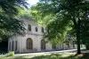
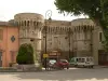
Monument - Castle of Chamaret
Monument - Abbey Notre-Dame d'Aiguebelle (Montjoyer)
Monument - Abbey Notre-Dame du Bosquet (Bouchet)
Monument - Castle of Grignan (Grignan)
Monument - Castle of Rochefort-en-Valdaine (Rochefort-en-Valdaine)
Monument - Castle of Simiane (Valréas)
Monument - Castle of Suze-la-Rousse (Suze-la-Rousse)
Monument - Cathedral Notre-Dame (Saint-Paul-Trois-Châteaux)
Monument - Chapel of the Pénitents Blancs (La Garde-Adhémar)
Monument - Church Notre-Dame-de-Nazareth (Valréas)
Monument - Church Saint-Michel (La Garde-Adhémar)
Monument - Church Sainte-Croix (La Baume-de-Transit)
Monument - Collegiate Church Saint-Sauveur (Grignan)
Monument - Commandry of the Templiers (Richerenches)
Monument - Priory of the Val des Nymphes (La Garde-Adhémar)
Monument - Private Mansion Pellissier (Visan)
Monument - Wash-house of Grignan (Grignan)
Sort by distance from starting point
Sort by difficulty
Sort by change in altitude
Sort by duration
Sort by length in kilometres
Filter results
Open map
Outing type
Hike
Cycling itinerary
Horse ride
Other means of transport
Distance from starting point
Less than 10 km
from 10 km to 30 km
More than 30 km
Difficulty
Easy
Intermediate
Athletic
Change in altitude
Less than 200 m
from 200 m to 500 m
from 500 m to 1000 m
More than 1000 m
Duration
Less than 2 h
from 2 h to 4 h
More than 4 h
Kilometres
Less than 5 km
from 5 km to 10 km
from 10 km to 20 km
More than 20 km
Territory
Dauphiné
Drôme-Ardèche
Languedoc-Roussillon
Provence
Filter results
Hide filters
Open map
Hide map
Outings in Chamaret
Outings around Chamaret
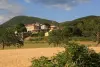
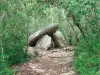
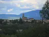
Pedestrian circuit to explore the village of Richerenches
8.5
2
Village visit in Richerenches
Easy
40 min, 1 km (change in altitude 0m)
Nice circuit and historical discovery of the Templar village.
Located
4.8 km
away of Chamaret
Favourite
Itinerary
Between vines, truffle fields and lavender
8.0
1
Hike in Richerenches
Easy
2:00, 11 km (change in altitude 0m)
2 easy and family circuits along vineyards, truffles and lavender fields. Loop n ° 2: rather recommended for mountain bikes and hybrid bikes (11 km) Loop n ° 3: rather recommended for pedestrians (8.5 km) Attention for loop n ° 2, there is…
Located
4.8 km
away of Chamaret
Favourite
Itinerary
Richerenches - Visan - Richerenches
8.0
1
Cycling itinerary in Richerenches
Easy
1:00, 16 km (change in altitude 72m)
Easy, family circuit by bike, VTC or pedestrian. Not recommended in windy conditions strong. Remarkable points of view on the Mont Ventoux and the Lance.
Located
5.2 km
away of Chamaret
Favourite
Itinerary
Olive Tree Trail
8.5
2
Hike in Nyons
Easy
1:30, 4 km (change in altitude 384m)
Discover the culture of the olive tree through the path of the olive tree punctuated with information panels that will reveal some secrets of this legendary tree.
Located
21 km
away of Chamaret
Favourite
Itinerary
On the trail of the hermit
7.9
14
Hike in Saint-Montan
Intermediate
3:00, 12 km (change in altitude 200m)
Above the medieval village of Saint-Montan, you will walk along a cliff in a very wild environment to Calvary marking the location of the cave where lived in the seventh century a hermit, Saint Montan (its history is evoked in a children's book…
Located
21 km
away of Chamaret
Favourite
Itinerary
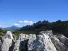
Dentelles de Montmirail Massif
7.7
63
Hike in Gigondas
Easy
2:00, 7 km (change in altitude 200m)
Easy walk for all. You will find a typical Mediterranean plant life and protected plants and animals. Wear a good pair of walking shoes and carry water and a whistle (during the hunting season). Respect nature (remove your waste) and the silence.…
Located
27 km
away of Chamaret
Favourite
Itinerary
The Coucourdoise
5.0
2
Hike in La Coucourde
Easy
3:00, 14 km (change in altitude 150m)
Stroll the village of La Coucourde.
Located
29 km
away of Chamaret
Favourite
Itinerary
7.1
15
Hike in Saou
Intermediate
5:40, 12 km (change in altitude 1061m)
Located
34 km
away of Chamaret
Favourite
Itinerary
Vaunaveys Crest
5.7
3
Hike in Vaunaveys-la-Rochette
Easy
1:30, 11 km (change in altitude 40m)
Family walk between Vaunaveys and Crest. Provide car home if you have little time. If you choose the Saturday morning market Crest is a must!
Located
43 km
away of Chamaret
Favourite
Itinerary
7.5
6
Hike in Ruoms
Intermediate
2:40, 8 km (change in altitude 256m)
Located
43 km
away of Chamaret
Favourite
Itinerary
Dolmens walk
6.0
10
Hike in Barjac
Easy
1:45, 8 km (change in altitude 0m)
Amid the woods and scrubland, set off to explore the dolmens in the woods of Barjac. No particular difficulties, gradual inclines.
Located
44 km
away of Chamaret
Favourite
Itinerary
Fountains of Pernes
7.7
14
Village visit in Pernes-les-Fontaines
Easy
2:00, 2 km (change in altitude 0m)
Discover the 40 fountains in the village. Some are obvious: Cormoran Fountain, Gigot Fountain, Reboul Fountain, Ange Fountain.... others are more surprising: Font de la Lune... Some will require more patience and perspicacity. A walk for all…
Located
47 km
away of Chamaret
Favourite
Itinerary
Around the Comtat Venaissin
7.3
3
Village visit in La Roque-sur-Pernes
Easy
2:00, 6 km (change in altitude 0m)
Visit to three typical Provencal country villages.
Located
50 km
away of Chamaret
Favourite
Itinerary
La Dolce Via
7.1
10
Cycling itinerary in Les Ollières-sur-Eyrieux
Easy
5:30, 90 km (change in altitude 300m)
La Dolce Via, built on an old railway line, winds between Saint-Agrève and Le Cheylard, Le Cheylard and La-Voulte-sur-Rhône, as well as between Le Cheylard and Lamastre. 90 km of pure happiness overlooking the Eyrieux valley, to discover on…
Located
50 km
away of Chamaret
Favourite
Itinerary
Upper Blajoux Valley
6.0
23
Hike in Sanilhac
Easy
1:30, 4 km (change in altitude 100m)
Walk through the chestnut grove along old paved paths, cross the hamlet of Marinier and an old bridge over the Blajoux stream.
Located
52 km
away of Chamaret
Favourite
Itinerary
7.5
4
Hike in Saint-Joseph-des-Bancs
Easy
1:10, 3 km (change in altitude 135m)
Located
53 km
away of Chamaret
Favourite
Itinerary
Winemaker's Trail
8.1
15
Hike in Lablachère
Easy
2:30, 8 km (change in altitude 80m)
Signposted winemaker's trail departing from the Lablachère wine cooperative. There is a large board presenting the itinerary at the car park. This path will lead you through the vineyards planted on terraces where Chatus, the emblematic grape…
Located
53 km
away of Chamaret
Favourite
Itinerary
Basilica of Our Lady (Notre-Dame) and megalithic bridge
7.8
7
Village visit in Lablachère
Easy
1:15, 5 km (change in altitude 0m)
This pleasant walk will take you from the Basilica of Our Lady of Good Help (Notre-Dame de Bonsecours) to La Jaujon, via the megalithic bridge…
Located
54 km
away of Chamaret
Favourite
Itinerary
Lavender Path
7.9
26
Hike in Sault
Easy
1:40, 5 km (change in altitude 80m)
From Sault, the lavender capital, this path allows you to discover this symbol of Provence while it is in bloom (July and August), but is also enjoyable at other times of the year. Follow the interpretation boards (botanic, culture, harvest,…
Located
54 km
away of Chamaret
Favourite
Itinerary
Défends Wood
7.8
4
Hike in Sault
Easy
2:20, 7 km (change in altitude 115m)
The seigniorial reserve of Défends Wood, where it was forbidden to graze livestock, reminds us that the kingdom's best wood was extracted from these forests in order to build the fleet under Colbert.
Located
54 km
away of Chamaret
Favourite
Itinerary
7.4
12
Hike in Vallées-d'Antraigues-Asperjoc
Intermediate
3:55, 8 km (change in altitude 752m)
Located
55 km
away of Chamaret
Favourite
Itinerary
Vineyard circuit
5.1
8
Hike in Ponet-et-Saint-Auban
Easy
1:00, 5 km (change in altitude 90m)
An enclosed valley, a picturesque village, lovingly tended vines… The Ponet Valley exudes a harmony that reveals the true face of winegrowing in Diois. Between two marly ridges planted with pine trees, the patchwork of vines unfurls and hugs…
Located
55 km
away of Chamaret
Favourite
Itinerary
From the Spring to the Venice of Provence
6.4
16
Cycling itinerary in L'Isle-sur-la-Sorgue
Easy
2:00, 21 km (change in altitude 0m)
From the Spring to the Venice of Provence: Distance: 21 km - Time required: 2 hours. The major sites of the Sorgue await you during this outing, the watershed, the abyss and the canals which wind their way through the fields. A whole world is…
Located
56 km
away of Chamaret
Favourite
Itinerary
Corniche Casteljau
8.0
1
Hike in Casteljau
Easy
1:30, 4 km (change in altitude 388m)
Pretty hiking in the woods Païolive, at any age, mixing ride under oaks and on the limestone plateau. Great view of the Chassezac.
Located
56 km
away of Chamaret
Favourite
Itinerary
5.8
14
Hike in Jaujac
Easy
1:25, 4 km (change in altitude 165m)
Located
56 km
away of Chamaret
Favourite
Itinerary
See more results
By continuing to browse our site, you are agreeing to the use of cookies to improve your experience and make targeted offers.
Find out more and make settings
Close
Your account
Continue with my email