Liven up your holidays!
Destination
State your preferences
Guide
Plan your stay
Your account
English
Français
Deutsch
Italiano
Español
Nederlands
Português
Русский
简体中文
日本語
0
0
0
Fontrieu
Menu
Tourism
Gastronomy
Outings
Activities
Events
Restaurants
Hotels
Vacation rentals
Bed & breakfasts
Campsites
Holiday insurance
Rental car
Train tickets
Plane tickets
Transfers
Holiday insurance
Holiday insurance
French courses
Romantic weekend
Family weekend
Cheap weekend
Unusual weekend
Find my position
Confirm
Discover
Tourist sites
Gastronomy
Cities & towns
Tourism labels
Themed itineraries
Custom itineraries
Photos
Panoramas
Tourism quiz
Going out
Leisure activities
Outings
Events
Restaurants
Stay
Hotels
Bed & breakfasts
Vacation rentals
Campsites
Travel
Rental car
Train tickets
Plane tickets
Holiday insurance
Information sheets
French courses
Outings
Around Fontrieu
Outings in Fontrieu
Ideas for walks and hikes in Fontrieu
Search
Cancel
29
outings found
Fontrieu
Change
Adjust destination
Town centre of Fontrieu
Locality - Former locality Castelnau-de-Brassac
Locality - Former locality Ferrières
Locality - Former locality Le Margnès
Transport - Airport of Castres - Mazamet (Labruguière)
Transport - Train station of Mazamet (Mazamet)
Information point - Inter-communal Tourist Office of the Sidobre (Le Bez)
Information point - Tourist Office of La Salvetat-sur-Agout (La Salvetat-sur-Agout)
Information point - Tourist Office of Mazamet (Mazamet)
Information point - Tourist Office of Montredon-Labessonnié (Montredon-Labessonnié)
Information point - Tourist Office of Saint-Pierre-de-Trivisy (Saint-Pierre-de-Trivisy)
Information point - Visitor Information Centre of Anglès (Anglès)
Information point - Visitor Information Centre of Brassac (Brassac)
Information point - Visitor Information Centre of Roquecourbe (Roquecourbe)
Information point - Visitor Information Centre of Vabre (Vabre)
Leisure centre - Museum of the Protestantisme en Haut-Languedoc
Leisure centre - Casino of Lacaune (Lacaune)
Leisure centre - Golf Course of Mazamet-la-Barouge (Pont-de-Larn)
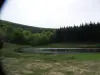
Leisure centre - Leisure Centre of the Lac du Laouzas (Nages)
Leisure centre - Skating Rink L'Archipel (Castres)
Monument - Castle of Ferrières
Monument - Bridge of Saint-Étienne (La Salvetat-sur-Agout)
Monument - Castle of Campan (Anglès)
Monument - Castle of Lacaze (Lacaze)
Monument - Chapel Saint-Étienne-de-Cavall (La Salvetat-sur-Agout)
Monument - Fountain of the Pisseurs de Lacaune (Lacaune)
Monument - Menhir of Peyro-Lebado (Lacaune)
Performance hall - Community Hall of Lacabarède (Lacabarède)
Performance hall - Espace Apollo - Palais des Congrès (Mazamet)
Performance hall - Le Tortill'Art (Saint-Amans-Soult)
Sort by distance from starting point
Sort by difficulty
Sort by change in altitude
Sort by duration
Sort by length in kilometres
Filter results
Open map
Outing type
Hike
Cycling itinerary
Horse ride
Other means of transport
Distance from starting point
Less than 10 km
from 10 km to 30 km
More than 30 km
Difficulty
Easy
Intermediate
Athletic
Change in altitude
Less than 200 m
from 200 m to 500 m
from 500 m to 1000 m
More than 1000 m
Duration
Less than 2 h
from 2 h to 4 h
More than 4 h
Kilometres
Less than 5 km
from 5 km to 10 km
from 10 km to 20 km
More than 20 km
Territory
Languedoc-Roussillon
Massif Central
Midi-Pyrénées
Filter results
Hide filters
Open map
Hide map
Outings in Fontrieu
Outings around Fontrieu
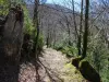
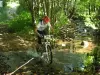
Haut-Languedoc - Passa Païs Greenway
8.1
9
Cycling itinerary in Mazamet
Easy
6:00, 90 km (change in altitude 50m)
Old railway line suitable for walkers, cyclists and horse riders. Several sites to be visited along the way.
Located
21 km
away of Fontrieu
Favourite
Itinerary
9.1
4
Hike in Nages
Intermediate
2:20, 7 km (change in altitude 203m)
Located
21 km
away of Fontrieu
Favourite
Itinerary
9.2
1
Hike in Nages
Intermediate
1:20, 4 km (change in altitude 114m)
Located
21 km
away of Fontrieu
Favourite
Itinerary
7.0
3
Hike in Labruguière
Easy
20 min, 1 km (change in altitude 14m)
Located
23 km
away of Fontrieu
Favourite
Itinerary
Carbonéral Path
6.5
13
Hike in Labruguière
Intermediate
5:15, 21 km (change in altitude 600m)
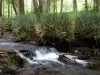
Secret and mysterious, the Black Mountain dominates the Thoré valley and the Lauragais plain. It outlines the contours of the Park and guides visitors to the heart of Haut-Languedoc. This path will offer you the chance to visit Montaud forest…
Located
24 km
away of Fontrieu
Favourite
Itinerary
Lo Camin de las Peyras
4.5
2
Hike in Navès
Easy
3:00, 11 km (change in altitude 200m)
The route of this itinerary is an opportunity to discover elements of local heritage that constitute the particularity of the village. Among the most emblematic and interesting, we note: the remains of an old quarry stone Navès (long used in…
Located
25 km
away of Fontrieu
Favourite
Itinerary
Les Tourelles
7.8
5
Hike in Murat-sur-Vèbre
Intermediate
4:00, 12 km (change in altitude 320m)
On the edge of the upper lands of Monts de Lacaune, the village of Murat is the perfect starting point for this walk over the mountains of Upper Languedoc, passing through hamlets to the summits and the magnificent 360° panoramic views over…
Located
28 km
away of Fontrieu
Favourite
Itinerary
Roy Quarries
5.8
11
Hike in Caunes-Minervois
Easy
2:30, 7 km (change in altitude 121m)
Marble is present along the length of the circuit leading to the Roy Quarries, from which the Trianon columns were extracted. Very beautiful panoramic viewpoint over the Pyrenees when the weather is fine. Sweeping view over Argent-Double and Cros.
Located
36 km
away of Fontrieu
Favourite
Itinerary
Versants of the Hard
8.0
1
Hike in Cuxac-Cabardès
Intermediate
5:30, 17 km (change in altitude 600m)
The territory around Cuxac-Cabardès is crossed by the River Dure, a river that once turned many mills. Following this route, you will go from one side to the other, sometimes wooded, sometimes open on an open view overlooking the Pyrenees.
Located
36 km
away of Fontrieu
Favourite
Itinerary
Capitoul... capitelles and dolmens
7.2
5
Hike in Villeneuve-Minervois
Intermediate
3:10, 11 km (change in altitude 350m)
PDIPR walk to the north of the village. Middle mountain landscapes. Climb up through the forests and visit the capitelle stone huts and dolmens and enjoy the view over the Minervois plain. Suitable for mountain bikes.
Located
37 km
away of Fontrieu
Favourite
Itinerary
Mont Méla Loop
8.0
5
Hike in Mélagues
Easy
2:00, 5 km (change in altitude 221m)
This short and varied walk offers beautiful views over the mountains around Mélagues. Walk up along the GR 71, past Cayourtes and Planquettes Farms to Mélagues along the path which children once used to get to school.
Located
42 km
away of Fontrieu
Favourite
Itinerary
The Small Tower
7.4
3
Hike in Mélagues
Intermediate
3:00, 8 km (change in altitude 288m)
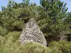
In the 1950s, the quil (small tower) was built by the shepherd Léon Gastines, who used to watch the flocks in Les Planquettes. As he watched his flocks, stone by stone, over the days and weeks, the tower started to take shape and became a pretty…
Located
42 km
away of Fontrieu
Favourite
Itinerary
The Vayssède and the Thalis Ford
8.1
1
Hike in Mélagues
Easy
1:30, 5 km (change in altitude 206m)
Easy short walk offering you the chance to admire the wild and rural surroundings of Mélagues. Pass the Vayssède Farm and make your way to the village via the ford over the Thalis Nuéjouls confluence.
Located
42 km
away of Fontrieu
Favourite
Itinerary
Fanjaud Ravine
7.7
4
Hike in Mélagues
Intermediate
3:00, 7 km (change in altitude 300m)
Pleasant walk, admire the exceptional plant and animal life along the mountain paths and trails and breathe the fresh fragrance of the wild plants to be found along the way.
Located
42 km
away of Fontrieu
Favourite
Itinerary
Cayla Forestry House
7.6
2
Hike in Mélagues
Easy
2:00, 6 km (change in altitude 250m)
Admire the beautiful views over the farms of Mélagues during this short walk. Pass behind the forestry house and return to Mélagues via the small wooden bridge.
Located
42 km
away of Fontrieu
Favourite
Itinerary
Watchtower and Rascas Lake
9.4
3
Hike in Mélagues
Athletic
4:00, 11 km (change in altitude 650m)
This adventurous walk offers magnificent views over the mountains of Aveyron and Hérault from the O.N.F watchtower. Pass the Cayla Forestry House and walk past Rascas Lake (D.F.C.I. water reserve). Return to Mélagues via the GR71.
Located
42 km
away of Fontrieu
Favourite
Itinerary
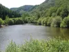
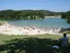
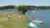
Lake Jouarres
7.6
21
Hike in Olonzac
Easy
1:30, 5 km (change in altitude 0m)
Easy walk. Lake with artificial beach, supervised in the summer, water sports in season (windsurfing, sailint, etc.), Canal du Midi and water sports centre close by.
Located
45 km
away of Fontrieu
Favourite
Itinerary
The sanctuary of Notre-Dame-de-Capimont
8.0
1
Hike in Lamalou-les-Bains
Easy
3:00, 9 km (change in altitude 318m)
The Notre-Dame-de-Capimont sanctuary, dedicated to the Virgin, overlooks the Orb valley, perched 400 meters above Lamalou-les-Bains and Hérépian. It bears witness to the religious past of the neighboring villages. We discover in the middle of…
Located
46 km
away of Fontrieu
Favourite
Itinerary
Orb Mountains Arboretum
7.4
10
Hike in Camplong
Intermediate
5:00, 11 km (change in altitude 800m)
Botanical trail. During the walk, you will cross two rivers (be careful during spates). Ask for information at Camplong town hall. The landscape changes as the walkers progress. You may meet mountain bikers coming the opposite way. Boar hunting…
Located
49 km
away of Fontrieu
Favourite
Itinerary
Saint Sauveur Chapel Walk
6.6
11
Hike in Camplong
Easy
2:00, 8 km (change in altitude 435m)
12th century chapel built on the hill of Saint Sauveur to the northwest of the village square. It dominates the ancient chestnut grove and protects the village.
Located
49 km
away of Fontrieu
Favourite
Itinerary
Mountain bike outing in the Orb Mountains
7.9
5
Mountain bike itinerary in Camplong
Athletic
3:30, 35 km (change in altitude 625m)
Outing around the Orb Mountains and the Wind Farm.
Located
49 km
away of Fontrieu
Favourite
Itinerary
Camp Nègre Wind Farm walk
6.7
6
Hike in Camplong
Easy
3:30, 10 km (change in altitude 357m)
Visit the wind Camp Negro Park, installed in spring 2009. Mining Conversion and transition in the former mining (coal) and stunning views. The walk from the school of Camplong is generally easy and enjoyable, despite some steep climbs. However,…
Located
49 km
away of Fontrieu
Favourite
Itinerary
From the city of Carcassonne to Lake La Cavayère
9.0
9
Cycling itinerary in Carcassonne
Easy
5:00, 8 km (change in altitude 0m)
Set off to discover the fortified town of Saint-Louis and the medieval city of Carcassonne, before heading towards Lake La Cavayère, stopping at the Australian Park along the way.
Located
50 km
away of Fontrieu
Favourite
Itinerary
The Arasses
8.0
1
Village visit in Villefranche-de-Panat
Easy
2:00, 4 km (change in altitude 67m)
A stroll along the trails and paths linking La Besse and Villefranche-de-Panat. It will delight young and old.
Located
51 km
away of Fontrieu
Favourite
Itinerary
9.5
6
Cycling itinerary in Villefranche-de-Panat
Intermediate
50 min, 12 km (change in altitude 152m)
Located
52 km
away of Fontrieu
Favourite
Itinerary
See more results
By continuing to browse our site, you are agreeing to the use of cookies to improve your experience and make targeted offers.
Find out more and make settings
Close
Your account
Continue with my email