
Favourite
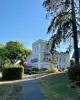
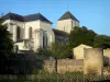
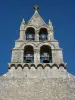
Futuroscope Park
| Municipality | Villiers |
|---|---|
| Postcode | 86190 |
| Latitude | 46.6763990 (N 46° 40’ 35”) |
| Longitude | 0.1761250 (E 0° 10’ 34”) |
| Altitude | From 118m to 150m |
| Surface area | 10.87 km² |
| Population | 951 inhabitants |
| Density | 87 inhabitants/km² |
| Prefecture | Poitiers (23 km, 24 min) |
| Insee code | 86292 |
| Intercommunality | CC du Haut-Poitou |
| Department | Vienne |
| Territory | Poitou |
| Region | New-Aquitaine |
| Vouillé | 4.9 km (8 min) |
|---|---|
| Yversay | 5.2 km (6 min) |
| Champigny en Rochereau | 5.3 km (8 min) |
| Cissé | 6 km (8 min) |
| Frozes | 6.4 km (8 min) |
| Chiré-en-Montreuil | 7.1 km (9 min) |
| Vouzailles | 8 km (9 min) |
| Maillé | 8.5 km (9 min) |
| Chabournay | 8.8 km (15 min) |
| Neuville-de-Poitou | 8.9 km (11 min) |
| Ayron | 11 km (12 min) |
| Amberre | 11.2 km (14 min) |
| Latillé | 12.1 km (15 min) |
| Avanton | 12.7 km (15 min) |
| Last name | Outing type | Difficulty | Duration | Departure municipality |
|---|---|---|---|---|
 | Hike | Easy | 3:00 | Mouterre-Silly (35 km) |
 | Hike | Easy | 2:00 | Ternay (44 km) |
 | Hike | Easy | 1:30 | Nouâtre (50 km) |
 | All-terrain bike itinerary | Easy | 2:30 | Lussac-les-Châteaux (52 km) |
 | All-terrain bike itinerary | Easy | 3:20 | Lussac-les-Châteaux (52 km) |