
Favourite
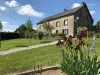
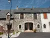
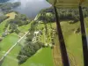
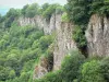
The site of Saint-Nazaire
| Municipality | Veyrières |
|---|---|
| Postcode | 19200 |
| Latitude | 45.4833620 (N 45° 29’ 0”) |
| Longitude | 2.3970550 (E 2° 23’ 49”) |
| Altitude | From 595m to 722m |
| Surface area | 4.10 km² |
| Population | 78 inhabitants |
| Density | 19 inhabitants/km² |
| Prefecture | Tulle (72 km, 54 min) |
| Insee code | 19283 |
| Intercommunality | CC Haute-Corrèze Communauté |
| Department | Corrèze |
| Territories | Limousin, Massif Central |
| Region | New-Aquitaine |
| Saint-Victour | 3.8 km (8 min) |
|---|---|
| Margerides | 4.5 km (7 min) |
| Saint-Bonnet-près-Bort | 4.8 km (8 min) |
| Saint-Exupéry-les-Roches | 6.3 km (9 min) |
| Thalamy | 8.7 km (13 min) |
| Saint-Fréjoux | 10.1 km (16 min) |
| Ussel | 11.5 km (15 min) |
| Roche-le-Peyroux | 11.8 km (19 min) |
| Sarroux - Saint Julien | 11.8 km (16 min) |
| Mestes | 12.7 km (18 min) |
| Monestier-Port-Dieu | 14.4 km (24 min) |
| Bort-les-Orgues | 15 km (18 min) |
| Saint-Étienne-la-Geneste | 15 km (19 min) |
| Valiergues | 15.7 km (19 min) |
| Last name | Activity type | Rate | City |
|---|---|---|---|
 | Sports sensations | 20 € | Lanobre (9.7 km) |
| Last name | Outing type | Difficulty | Duration | Departure municipality |
|---|---|---|---|---|
 | Hike | Intermediate | 2:00 | Veyrières (16.1 km) |
 | Hike | Intermediate | 2:30 | Saint-Genès-Champespe (27 km) |
 | Cycling itinerary | Intermediate | 40 min | Picherande (30 km) |
 | Cycling itinerary | Intermediate | 20 min | Murat-le-Quaire (31 km) |
 | Cycling itinerary | Athletic | 35 min | Mont-Dore (34 km) |