
Favourite
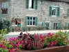
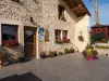
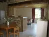
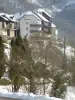
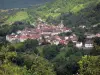
Mouthier-Haute-Pierre


| Municipality | Vernierfontaine |
|---|---|
| Postcode | 25580 |
| Tourism label | ") |
| Latitude | 47.1078720 (N 47° 6’ 28”) |
| Longitude | 6.2991750 (E 6° 17’ 57”) |
| Altitude | From 603m to 769m |
| Surface area | 13.28 km² |
| Population | 493 inhabitants |
| Density | 37 inhabitants/km² |
| Prefecture | Besançon (32 km, 27 min) |
| Insee code | 25605 |
| Intercommunality | CC des Portes du Haut-Doubs |
| Department | Doubs |
| Territories | Franche-Comté, Jura mountains |
| Region | Burgundy-Franche-Comté |
| Fallerans | 4.3 km (7 min) |
|---|---|
| Les Premiers Sapins | 4.9 km (8 min) |
| Étray | 4.9 km (12 min) |
| Guyans-Durnes | 5.2 km (9 min) |
| Voires | 6.2 km (10 min) |
| Étalans | 6.4 km (9 min) |
| Durnes | 6.5 km (12 min) |
| Valdahon | 6.5 km (9 min) |
| Lavans-Vuillafans | 7.5 km (12 min) |
| Échevannes | 9 km (15 min) |
| Chevigney-lès-Vercel | 9.6 km (13 min) |
| Épenoy | 9.7 km (12 min) |
| Lods | 11.1 km (18 min) |
| Adam-lès-Vercel | 11.2 km (14 min) |
| Mouthier-Haute-Pierre | 12.8 km (20 min) |

| Last name | Activity type | Rate | City |
|---|---|---|---|
 | Entertainment | 84 € to 110 € | Besançon (25 km) |
| Last name | Outing type | Difficulty | Duration | Departure municipality |
|---|---|---|---|---|
 | Hike | Intermediate | 35 min | Hauterive-la-Fresse (19.8 km) |
 | Hike | Easy | 1:05 | La Rivière-Drugeon (28 km) |
 | Hike | Easy | 6:00 | Devecey (32 km) |
 | Hike | Easy | 1:00 | Pays-de-Clerval (35 km) |
 | Hike | Easy | 3:00 | Arbois (46 km) |