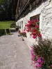

Favourite
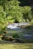
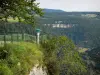
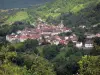
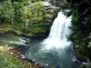
The Consolation rock formations
| Municipality | Vellerot-lès-Vercel |
|---|---|
| Postcode | 25530 |
| Tourism label | ") |
| Latitude | 47.2435199 (N 47° 14’ 37”) |
| Longitude | 6.4471940 (E 6° 26’ 50”) |
| Altitude | From 559m to 703m |
| Surface area | 4.57 km² |
| Population | 70 inhabitants |
| Density | 15 inhabitants/km² |
| Prefecture | Besançon (46 km, 46 min) |
| Insee code | 25596 |
| Intercommunality | CC des Portes du Haut-Doubs |
| Department | Doubs |
| Territories | Franche-Comté, Jura mountains |
| Region | Burgundy-Franche-Comté |
| Villers-la-Combe | 1.9 km (3 min) |
|---|---|
| Villers-Chief | 2 km (4 min) |
| Landresse | 2.7 km (4 min) |
| Germéfontaine | 4.2 km (7 min) |
| Eysson | 5.4 km (7 min) |
| Ouvans | 5.7 km (7 min) |
| Bremondans | 6.7 km (11 min) |
| Courtetain-et-Salans | 6.8 km (11 min) |
| Grandfontaine-sur-Creuse | 7.3 km (10 min) |
| Domprel | 8 km (13 min) |
| Orsans | 8.9 km (13 min) |
| Vercel-Villedieu-le-Camp | 9.1 km (12 min) |
| Pierrefontaine-les-Varans | 10 km (17 min) |
| Épenouse | 10.1 km (15 min) |
| Laviron | 10.2 km (16 min) |
| Last name | Activity type | Rate | City |
|---|---|---|---|
 | Entertainment | 84 € to 110 € | Besançon (32 km) |
| Last name | Outing type | Difficulty | Duration | Departure municipality |
|---|---|---|---|---|
 | Hike | Easy | 1:00 | Pays-de-Clerval (17.1 km) |
 | Hike | Intermediate | 35 min | Hauterive-la-Fresse (31 km) |
 | Hike | Easy | 6:00 | Devecey (34 km) |
 | Hike | Intermediate | 35 min | Grand-Charmont (42 km) |
 | Hike | Easy | 1:05 | La Rivière-Drugeon (46 km) |