

Favourite
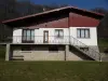
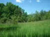
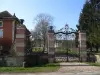
Vesoul
| Municipality | Vellefrie |
|---|---|
| Postcode | 70240 |
| Latitude | 47.7063900 (N 47° 42’ 23”) |
| Longitude | 6.2205769 (E 6° 13’ 14”) |
| Altitude | From 232m to 324m |
| Surface area | 5.91 km² |
| Population | 125 inhabitants |
| Density | 21 inhabitants/km² |
| Prefecture | Vesoul (13.4 km, 17 min) |
| Insee code | 70534 |
| Intercommunality | CC Terres de Saône |
| Department | Haute-Saône |
| Territory | Franche-Comté |
| Region | Burgundy-Franche-Comté |
| Varogne | 1.9 km (5 min) |
|---|---|
| La Villeneuve-Bellenoye-et-la-Maize | 2.4 km (4 min) |
| Flagy | 3.1 km (6 min) |
| Vilory | 3.7 km (9 min) |
| Mailleroncourt-Charette | 5.1 km (10 min) |
| Saulx | 5.3 km (9 min) |
| Auxon | 5.5 km (7 min) |
| Servigney | 7.2 km (14 min) |
| Neurey-en-Vaux | 7.5 km (10 min) |
| Creveney | 7.9 km (14 min) |
| Le Val-Saint-Éloi | 8 km (12 min) |
| Châteney | 8.3 km (15 min) |
| Pusy-et-Épenoux | 8.4 km (13 min) |
| Colombier | 8.5 km (13 min) |
| Last name | Activity type | Rate | City |
|---|---|---|---|
 | Culture and education | 11 € | Le Thillot (45 km) |
| Last name | Outing type | Difficulty | Duration | Departure municipality |
|---|---|---|---|---|
 | Hike | Easy | 1:05 | Ferrières-lès-Scey (16.2 km) |
 | Hike | Intermediate | 3:30 | Saint-Rémy-en-Comté (17.1 km) |
 | Hike | Easy | 2:05 | Scey-sur-Saône-et-Saint-Albin (19.6 km) |
 | Hike | Athletic | 5:05 | Fretigney-et-Velloreille (32 km) |
 | Hike | Intermediate | 2:10 | La Vôge-les-Bains (33 km) |