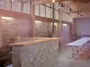
The town was founded in 1972 by the merger of municipalities Fourcinet, The Built Crèmezin and The Pilhon.


Favourite


The town was founded in 1972 by the merger of municipalities Fourcinet, The Built Crèmezin and The Pilhon.
| Municipality | Val-Maravel |
|---|---|
| Postcode | 26310 |
| Latitude | 44.5920000 (N 44° 35’ 31”) |
| Longitude | 5.5700000 (E 5° 34’ 12”) |
| Altitude | From 776m to 1690m |
| Surface area | 21.60 km² |
| Population | 51 inhabitants |
| Density | 2 inhabitants/km² |
| Prefecture | Valence (101 km, 1:43) |
| Insee code | 26136 |
| Intercommunality | CC du Diois |
| Department | Drôme |
| Territories | Dauphiné, Drôme-Ardèche |
| Region | Auvergne-Rhône-Alps |
| Beaurières | 3.3 km (9 min) |
|---|---|
| Lesches-en-Diois | 9 km (16 min) |
| Charens | 9.7 km (16 min) |
| Les Prés | 11 km (18 min) |
| Valdrôme | 13.2 km (21 min) |
| Beaumont-en-Diois | 13.5 km (18 min) |
| La Beaume | 17.6 km (24 min) |
| Luc-en-Diois | 17.9 km (20 min) |
| La Haute-Beaume | 18.3 km (26 min) |
| La Bâtie-des-Fonds | 18.6 km (27 min) |
| Montlaur-en-Diois | 21 km (23 min) |
| Montmaur-en-Diois | 21 km (23 min) |
| Miscon | 21 km (25 min) |
| Poyols | 22 km (26 min) |
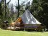
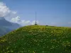
Many walks can take you to neighboring municipalities, Boulc by the neck or cervical King Louis, Lesch, Montbrand by the collar of Gaud, Beaurières the Col de Cabre, and the Pre Soubeyrand, Miscon by the mountain of Puy.
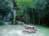
The town is crossed by the GR 91 from Grenoble to Fontaine de Vaucluse and through the Vercors mountains of Vaucluse.
| Last name | Activity type | Rate | City |
|---|---|---|---|
 | Nature and the great outdoors | 50 € to 375 € | Éourres (44 km) |
 | Local flavours | 15 € | Pont-de-Barret (47 km) |
 | Arts and Crafts | 30 € | Saint-Vincent-sur-Jabron (49 km) |
| Last name | Outing type | Difficulty | Duration | Departure municipality |
|---|---|---|---|---|
 | Hike | Intermediate | 2:15 | La Faurie (13.7 km) |
 | Hike | Athletic | 7:30 | Monestier-du-Percy (24 km) |
 | Hike | Intermediate | 5:00 | Mens (29 km) |
 | Hike | Easy | 1:00 | Ponet-et-Saint-Auban (29 km) |
 | Hike | Intermediate | 5:40 | Saou (36 km) |