


Favourite
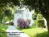
Moncontour
| Municipality | Trédaniel |
|---|---|
| Postcode | 22510 |
| Latitude | 48.3596160 (N 48° 21’ 35”) |
| Longitude | -2.6186130 (W 2° 37’ 7”) |
| Altitude | From 86m to 331m |
| Surface area | 15.92 km² |
| Population | 920 inhabitants |
| Density | 57 inhabitants/km² |
| Prefecture | Saint-Brieuc (26 km, 30 min) |
| Insee code | 22346 |
| Intercommunality | CA Lamballe Terre et Mer |
| Department | Côtes-d'Armor |
| Region | Brittany |
| Moncontour | 1.8 km (4 min) |
|---|---|
| Trébry | 5.6 km (8 min) |
| Bréhand | 6.9 km (8 min) |
| Saint-Trimoël | 7.2 km (12 min) |
| Plémy | 7.2 km (11 min) |
| Hénon | 7.9 km (12 min) |
| Saint-Glen | 8.1 km (10 min) |
| Quessoy | 9.7 km (12 min) |
| Le Mené | 10.9 km (12 min) |
| Penguily | 11.3 km (15 min) |
| Landéhen | 11.9 km (15 min) |
| Ploeuc-L'Hermitage | 12.4 km (14 min) |
| Saint-Carreuc | 13.1 km (20 min) |
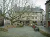
| Monuments |
|---|
| Last name | Outing type | Difficulty | Duration | Departure municipality |
|---|---|---|---|---|
 | Hike | Intermediate | 1:30 | Hillion (17.5 km) |
 | Hike | Easy | 2:30 | Hillion (17.5 km) |
 | Hike | Intermediate | 1:00 | Hillion (17.5 km) |
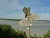 | Hike | Athletic | 5:10 | Hillion (17.5 km) |
 | Hike | Intermediate | 4:05 | Saint-Vran (18.8 km) |