


Favourite
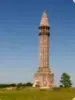
Domrémy-la-Pucelle
| Municipality | Tramont-Saint-André |
|---|---|
| Postcode | 54115 |
| Latitude | 48.4065640 (N 48° 24’ 24”) |
| Longitude | 5.9257230 (E 5° 55’ 33”) |
| Altitude | From 352m to 466m |
| Surface area | 6.88 km² |
| Population | 59 inhabitants |
| Density | 8 inhabitants/km² |
| Prefecture | Nancy (48 km, 52 min) |
| Insee code | 54531 |
| Intercommunality | CC du Pays de Colombey et du Sud Toulois |
| Department | Meurthe-et-Moselle |
| Territory | Lorraine |
| Region | Great East |
| Tramont-Émy | 2 km (3 min) |
|---|---|
| Soncourt | 2.5 km (5 min) |
| Aroffe | 2.6 km (4 min) |
| Tramont-Lassus | 3.7 km (6 min) |
| Vicherey | 3.7 km (9 min) |
| Gémonville | 4.7 km (6 min) |
| Pleuvezain | 4.9 km (7 min) |
| Beuvezin | 5.5 km (11 min) |
| Aouze | 6.4 km (10 min) |
| Maconcourt | 7.2 km (12 min) |
| Favières | 7.9 km (20 min) |
| Saulxerotte | 9 km (21 min) |
| Grimonviller | 9 km (15 min) |
| Fécocourt | 9.2 km (17 min) |
| Last name | Activity type | Rate | City |
|---|---|---|---|
 | Local flavours | Free | Sorcy-Saint-Martin (40 km) |
| Last name | Outing type | Difficulty | Duration | Departure municipality |
|---|---|---|---|---|
 | Hike | Easy | 7:35 | Vaudémont (10.7 km) |
 | Hike | Easy | 1:55 | Neufchâteau (17.1 km) |
 | Hike | Intermediate | 3:20 | Maxey-sur-Meuse (17.7 km) |
 | Hike | Intermediate | 5:00 | Charmes (27 km) |
 | Hike | Intermediate | 3:00 | Dompaire (30 km) |


