
Favourite
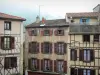
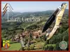
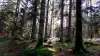
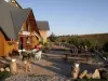
Livradois-Forez Regional Nature Park
| Municipality | Tours-sur-Meymont |
|---|---|
| Postcode | 63590 |
| Latitude | 45.6707780 (N 45° 40’ 15”) |
| Longitude | 3.5775230 (E 3° 34’ 39”) |
| Altitude | From 360m to 823m |
| Surface area | 18.09 km² |
| Population | 537 inhabitants |
| Density | 29 inhabitants/km² |
| Prefecture | Clermont-Ferrand (67 km, 57 min) |
| Insee code | 63434 |
| Intercommunality | CC Ambert Livradois Forez |
| Department | Puy-de-Dôme |
| Territories | Auvergne, Massif Central |
| Region | Auvergne-Rhône-Alps |
| Cunlhat | 5.2 km (7 min) |
|---|---|
| Domaize | 6.5 km (9 min) |
| Saint-Gervais-sous-Meymont | 7.4 km (9 min) |
| Olliergues | 10.7 km (12 min) |
| Saint-Dier-d'Auvergne | 12.7 km (20 min) |
| Augerolles | 13.1 km (15 min) |
| Auzelles | 13.6 km (17 min) |
| Ceilloux | 13.6 km (15 min) |
| Sauviat | 14 km (18 min) |
| La Chapelle-Agnon | 14.1 km (17 min) |
| Saint-Flour-l'Étang | 14.5 km (24 min) |
| Saint-Éloy-la-Glacière | 15.8 km (22 min) |
| Courpière | 16 km (17 min) |
| Marat | 16.8 km (18 min) |

| Last name | Activity type | Rate | City |
|---|---|---|---|
 | Nature and the great outdoors | 27 € to 90 € | Vollore-Montagne (16.2 km) |
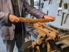 | Arts and Crafts | Free | La Monnerie-le-Montel (22 km) |
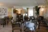
 | Well-being | 87 € to 170 € | Lezoux (24 km) |
 | Arts and Crafts | Free | Arconsat (26 km) |
 | Well-being | 65 € to 155 € | Ferrières-sur-Sichon (40 km) |
| Last name | Outing type | Difficulty | Duration | Departure municipality |
|---|---|---|---|---|
 | Hike | Easy | 2:30 | Auzelles (9.4 km) |
 | Hike | Intermediate | 2:35 | Job (16.7 km) |
 | Hike | Intermediate | 2:25 | Sallèdes (21 km) |
 | Hike | Intermediate | 3:10 | Saint-Anthème (24 km) |
 | Hike | Intermediate | 3:25 | Saint-Anthème (24 km) |