


Favourite
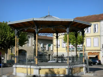
The fortified church of Simorre
| Municipality | Tachoires |
|---|---|
| Postcode | 32260 |
| Latitude | 43.4722180 (N 43° 28’ 20”) |
| Longitude | 0.6641049 (E 0° 39’ 51”) |
| Altitude | From 197m to 304m |
| Surface area | 9.61 km² |
| Population | 106 inhabitants |
| Density | 11 inhabitants/km² |
| Prefecture | Auch (26 km, 29 min) |
| Insee code | 32438 |
| Intercommunality | CC Val de Gers |
| Department | Gers |
| Territories | Gascony, Midi-Pyrénées |
| Region | Occitanie |
| Lamaguère | 2.4 km (4 min) |
|---|---|
| Moncorneil-Grazan | 2.6 km (3 min) |
| Monferran-Plavès | 4.4 km (8 min) |
| Pouy-Loubrin | 5.3 km (8 min) |
| Betcave-Aguin | 5.6 km (8 min) |
| Faget-Abbatial | 5.9 km (9 min) |
| Simorre | 6.6 km (8 min) |
| Seissan | 7.2 km (8 min) |
| Sère | 7.5 km (10 min) |
| Bellegarde | 7.5 km (11 min) |
| Meilhan | 8.4 km (11 min) |
| Villefranche-d'Astarac | 9.3 km (10 min) |
| Ornézan | 9.5 km (10 min) |
| Labarthe | 10.1 km (11 min) |
| Last name | Activity type | Rate | City |
|---|---|---|---|
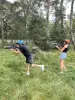 | Sports sensations | 15 € to 25 € | Lannemezan (46 km) |
| Last name | Outing type | Difficulty | Duration | Departure municipality |
|---|---|---|---|---|
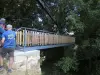 | Hike | Intermediate | 3:25 | Castelnau-Barbarens (12.5 km) |
 | Hike | Easy | 35 min | Lombez (19.9 km) |
 | Hike | Easy | 2:30 | Bazian (35 km) |
 | Village visit | Intermediate | 2:00 | Carbonne (49 km) |
 | Hike | Intermediate | 3:00 | Bize (50 km) |


