The inhabitants are Saivres Sapuriens and Sapuriennes. In 2011, they are Sapuriens 1355.


Favourite
The inhabitants are Saivres Sapuriens and Sapuriennes. In 2011, they are Sapuriens 1355.
| Municipality | Saivres |
|---|---|
| Postcode | 79400 |
| Latitude | 46.4320740 (N 46° 25’ 55”) |
| Longitude | -0.2367630 (W 0° 14’ 12”) |
| Altitude | From 52m to 185m |
| Surface area | 21.24 km² |
| Population | 1388 inhabitants |
| Density | 65 inhabitants/km² |
| Prefecture | Niort (26 km, 32 min) |
| Insee code | 79302 |
| Intercommunality | CC Haut Val de Sèvre |
| Department | Deux-Sèvres |
| Territory | Poitou |
| Region | New-Aquitaine |
| Saint-Maixent-l'École | 4 km (7 min) |
|---|---|
| Augé | 5.1 km (11 min) |
| Exireuil | 5.7 km (9 min) |
| Nanteuil | 6.6 km (11 min) |
| Saint-Martin-de-Saint-Maixent | 6.6 km (10 min) |
| Saint-Georges-de-Noisné | 7.4 km (9 min) |
| Azay-le-Brûlé | 7.8 km (12 min) |
| Souvigné | 9.5 km (13 min) |
| Sainte-Eanne | 10.4 km (15 min) |
| Clavé | 11 km (16 min) |
| Soudan | 11.5 km (13 min) |
| Verruyes | 11.6 km (15 min) |
| Romans | 11.9 km (18 min) |
| Saint-Christophe-sur-Roc | 12.4 km (14 min) |
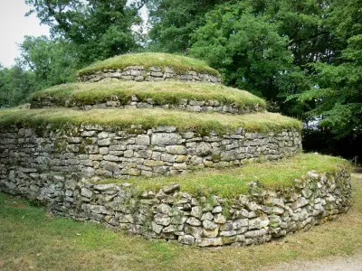
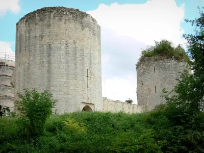
| Monuments |
|---|
| Last name | Outing type | Difficulty | Duration | Departure municipality |
|---|---|---|---|---|
 | Hike | Intermediate | 3:45 | Saint-Michel-le-Cloucq (40 km) |
 | Hike | Easy | 1:05 | Le Gué-de-Velluire (53 km) |
 | Hike | Easy | 1:05 | La Taillée (53 km) |
 | Hike | Easy | 1:00 | La Taillée (53 km) |
 | Hike | Easy | 3:45 | Puyrolland (56 km) |