

Favourite
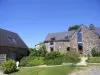
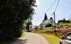
The Nantes to Brest canal
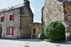


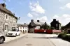
| Municipality | Saint-Thois |
|---|---|
| Postcode | 29520 |
| Latitude | 48.1647890 (N 48° 9’ 53”) |
| Longitude | -3.8845480 (W 3° 53’ 4”) |
| Altitude | From 28m to 238m |
| Surface area | 18.10 km² |
| Population | 739 inhabitants |
| Density | 40 inhabitants/km² |
| Prefecture | Quimper (30 km, 34 min) |
| Insee code | 29267 |
| Intercommunality | CC de Haute Cornouaille |
| Department | Finistère |
| Region | Brittany |
| Laz | 7.3 km (12 min) |
|---|---|
| Lennon | 8.3 km (14 min) |
| Gouézec | 8.4 km (12 min) |
| Châteauneuf-du-Faou | 8.7 km (11 min) |
| Trégourez | 10.2 km (14 min) |
| Edern | 11.6 km (11 min) |
| Lothey | 13.2 km (19 min) |
| Briec | 13.5 km (16 min) |
| Saint-Goazec | 13.7 km (17 min) |
| Plonévez-du-Faou | 15.6 km (19 min) |
| Coray | 15.6 km (19 min) |
| Leuhan | 16.4 km (24 min) |
| Spézet | 17 km (21 min) |

| Last name | Outing type | Difficulty | Duration | Departure municipality |
|---|---|---|---|---|
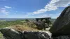 | Hike | Intermediate | 1:30 | Gouézec (6.6 km) |
 | Hike | Intermediate | 3:35 | Gouézec (8 km) |
 | Hike | Intermediate | 3:35 | Gouézec (9.5 km) |
 | Hike | Intermediate | 3:55 | Gourin (20 km) |
 | All-terrain bike itinerary | Athletic | 3:25 | Gourin (21 km) |