


Favourite
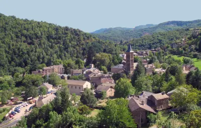
Le Pont-de-Montvert


| Municipality | Saint-Privat-de-Vallongue |
|---|---|
| Postcode | 48240 |
| Latitude | 44.2788900 (N 44° 16’ 44”) |
| Longitude | 3.8369400 (E 3° 50’ 13”) |
| Altitude | From 354m to 1353m |
| Surface area | 23.87 km² |
| Population | 230 inhabitants |
| Density | 9 inhabitants/km² |
| Prefecture | Mende (61 km, 1:02) |
| Insee code | 48178 |
| Intercommunality | CC des Cévennes au Mont Lozère |
| Department | Lozère |
| Territories | Languedoc-Roussillon, Massif Central |
| Region | Occitanie |
| Ventalon en Cévennes | 6.4 km (11 min) |
|---|---|
| Saint-Hilaire-de-Lavit | 9.6 km (18 min) |
| Cassagnas | 10.6 km (14 min) |
| Saint-Michel-de-Dèze | 11.5 km (20 min) |
| Le Collet-de-Dèze | 12.3 km (14 min) |
| Saint-André-de-Lancize | 12.8 km (17 min) |
| Sainte-Cécile-d'Andorge | 18.6 km (22 min) |
| Saint-Julien-des-Points | 19.9 km (25 min) |
| Vialas | 20 km (37 min) |
| Saint-Germain-de-Calberte | 21 km (29 min) |
| Branoux-les-Taillades | 24 km (28 min) |
| Saint-Martin-de-Boubaux | 26 km (40 min) |
| Barre-des-Cévennes | 28 km (31 min) |
| Pont de Montvert - Sud Mont Lozère | 28 km (39 min) |


| Last name | Activity type | Rate | City |
|---|---|---|---|
 | Nature and the great outdoors | 28 € to 55 € | Alès (29 km) |
 | Sports sensations | 16 € | Chassagnes (30 km) |
 | Sports sensations | 10 € to 42 € | Berrias-et-Casteljau (32 km) |
 | Sports sensations | 35 € | Casteljau (33 km) |
 | Sports sensations | 50 € to 55 € | Allègre-les-Fumades (33 km) |
| Last name | Outing type | Difficulty | Duration | Departure municipality |
|---|---|---|---|---|
 | Hike | Intermediate | 3:00 | Ventalon en Cévennes (2 km) |
 | Hike | Intermediate | 4:00 | Pont de Montvert - Sud Mont Lozère (11.9 km) |
 | Hike | Easy | 2:00 | Pont de Montvert - Sud Mont Lozère (11.9 km) |
 | Hike | Athletic | 5:25 | Moissac-Vallée-Française (13.5 km) |
 | Hike | Intermediate | 5:00 | Bonnevaux (17.6 km) |