Liven up your holidays!

Saint-Jean-du-Bruel

Tourism, holidays & weekends guide in the Aveyron

Saint-Jean-du-Bruel - Tourism, holidays & weekends guide in the Aveyron
7.6
10

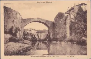
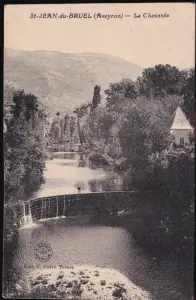
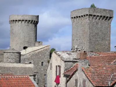
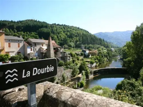
Between Causses and Cévennes, Saint-Jean-du Bruel, located in a green valley at an altitude of 520 m, is crossed by one of the most beautiful rivers in France: "the Dourbie".

Historically, this town, formerly Protestant, suffered harshly from the wars of religion. Converted back to Catholicism after the revocation of the Edict of Nantes, the church was rebuilt in 1710, but the village kept its temple.

Saint-Jean-du-Bruel is home to two pâté canneries, enough to satisfy lovers of local products!

Geographical information

MunicipalitySaint-Jean-du-Bruel
Postcode12230
Tourism label
Latitude44.0231740 (N 44° 1’ 23”)
Longitude3.3613280 (E 3° 21’ 41”)
AltitudeFrom 492m to 1339m
Surface area37.23 km²
Population724 inhabitants
Density19 inhabitants/km²
PrefectureRodez (101 km, 1:31)
Insee code12231
IntercommunalityCC Larzac et Vallées
DepartmentAveyron
TerritoriesMassif Central, Midi-Pyrénées
RegionOccitanie

Nearest cities & towns

Sauclières6.7 km (11 min)
Nant7.3 km (10 min)
Causse-Bégon8.8 km (17 min)
Trèves11.8 km (20 min)
Campestre-et-Luc12.5 km (18 min)
Dourbies14.4 km (23 min)
Alzon16.5 km (21 min)
La Couvertoirade19.4 km (22 min)
Revens21 km (27 min)
La Cavalerie21 km (24 min)
Lanuéjols22 km (36 min)
Saint-Sauveur-Camprieu23 km (36 min)
Sorbs23 km (34 min)
Le Cros24 km (33 min)
Arrigas24 km (32 min)

Things to see and do

Events and festivities

Photos

View of the Dourbie
View of the Dourbie
See photo
Les Halles
Les Halles
See photo
View of the village
View of the village
See photo
Le Pont Vieux
Le Pont Vieux
See photo
Platane des Halles around 1930
See photo
View from Roquebrune, early 1900
See photo
Pont Vieux around 1940
See photo
Fisherman watching trout around 1930
See photo

Weather

Friday 19 april
Min. 1°C - Max. 14°C
Day
Night
Saturday 20 april
Min. 3°C - Max. 12°C
Day
Night
Sunday 21 april
Min. 1°C - Max. 10°C
Day
Night

Visits, leisure and activities nearby

The Larzac et Vallées Tourist Office offers you some circuits: Don't forget, you are in a territory classified by UNESCO in 2011, concerning Agro-pastoralism.

Leisure activities

Last nameActivity typeRateCity
Canyoning or Via ferrata in the Grands Causses Park
Sports sensations40 € Millau (24 km)
Caving for all levels
Sports sensations50 € to 125 € Cazilhac (30 km)
Visit the Roquefort cheese ripening caves
Local flavoursFreeRoquefort-sur-Soulzon (30 km)
Discover Tarn by canoe & kayak
Sports sensations24 € to 26 € Comprégnac (33 km)
Canoe-Kayak in the Hérault gorges
Sports sensations20 € to 45 € Saint-Bauzille-de-Putois (33 km)

Outings

Last nameOuting typeDifficultyDurationDeparture municipality
Visit to a Knights Templar village
HikeEasy3:00Campestre-et-Luc (9 km)
Walk to Navacelles
HikeEasy3:00Campestre-et-Luc (9 km)
Serres of Blaquererie
HikeEasy4:00La Couvertoirade (12.8 km)
Saint-Gervais Path
HikeIntermediate4:00Hures-la-Parade (25 km)
The Lion’s Rock (Rocher du Lion)
Village visitEasy2:00La Bastide-Pradines (25 km)

Restaurants

Bed & breakfasts

Vacation rentals

Campsites

Hotels

Your holidays
A hotel
A vacation rental
A bed & breakfast
A campsite
A leisure activity
A restaurant
A rental car
A plane ticket
By continuing to browse our site, you are agreeing to the use of cookies to improve your experience and make targeted offers.
Find out more and make settings
Your account