


Favourite
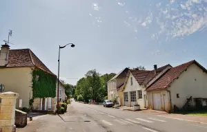
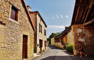
Saint-Jean-de-Côle


| Municipality | Saint-Germain-des-Prés |
|---|---|
| Postcode | 24160 |
| Latitude | 45.3422320 (N 45° 20’ 32”) |
| Longitude | 0.9936520 (E 0° 59’ 37”) |
| Altitude | From 127m to 297m |
| Surface area | 19.01 km² |
| Population | 474 inhabitants |
| Density | 24 inhabitants/km² |
| Prefecture | Périgueux (32 km, 36 min) |
| Insee code | 24417 |
| Intercommunality | CC Isle-Loue-Auvézère en Périgord |
| Department | Dordogne |
| Territories | Aquitaine, Périgord |
| Region | New-Aquitaine |
| Coulaures | 4.6 km (9 min) |
|---|---|
| Saint-Jory-las-Bloux | 5.3 km (9 min) |
| Saint-Martial-d'Albarède | 5.4 km (9 min) |
| Saint-Pantaly-d'Excideuil | 5.4 km (10 min) |
| Excideuil | 5.7 km (9 min) |
| Corgnac-sur-l'Isle | 6.8 km (9 min) |
| Saint-Médard-d'Excideuil | 7.6 km (11 min) |
| Eyzerac | 9.2 km (12 min) |
| Clermont-d'Excideuil | 9.4 km (15 min) |
| Mayac | 9.7 km (16 min) |
| Saint-Sulpice-d'Excideuil | 10.5 km (17 min) |
| Preyssac-d'Excideuil | 11.3 km (15 min) |
| Savignac-les-Églises | 11.4 km (16 min) |
| Saint-Raphaël | 11.7 km (18 min) |


| Last name | Activity type | Rate | City |
|---|---|---|---|
 | Sports sensations | 45 € | Excideuil (4.5 km) |
 | Sports sensations | 20 € | Cornille (20 km) |
 | Entertainment | 7 € to 10 € | Brantôme en Périgord (27 km) |
| Last name | Outing type | Difficulty | Duration | Departure municipality |
|---|---|---|---|---|
 | Hike | Easy | 4:00 | Saint-Mesmin (16.6 km) |
 | Hike | Intermediate | 4:00 | Antonne-et-Trigonant (19.2 km) |
 | Hike | Intermediate | 5:00 | Antonne-et-Trigonant (19.2 km) |
 | Cycling itinerary | Easy | 4:00 | Trélissac (23 km) |
 | Hike | Easy | 3:30 | Saint-Saud-Lacoussière (26 km) |


