Liven up your holidays!

Saint-Front

Tourism, holidays & weekends guide in the Haute-Loire

Saint-Front - Tourism, holidays & weekends guide in the Haute-Loire
9.1
9

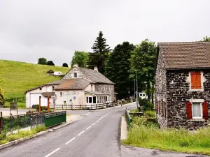
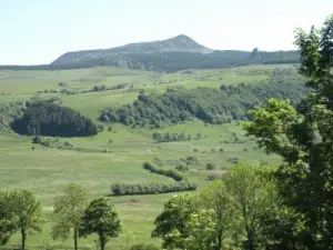
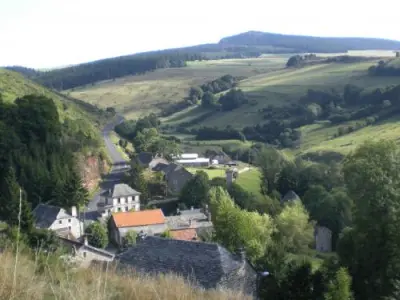
Small village of Haute-Loire located near the culmination of the Cevennes, Mount Mezenc, Saint-Front rises to more than 1200 meters above sea level and covers more than 5000 hectares. This charming mountain village is crossed by the 45th parallel north equidistant between the North Pole and the Earth's equator.

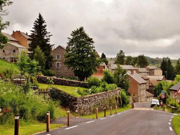
Formerly dependent Mas Bonnefond, the town of Saint-Front is actually born in the Middle Ages. The one that took the name of Ardennes in Mountain at the time of the French Revolution developed around its natural inheritance today very appreciated by the amateurs of outdoor life and mountain sports.

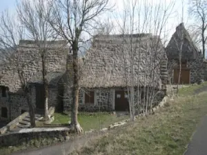
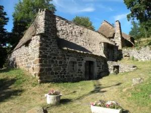
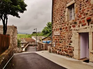
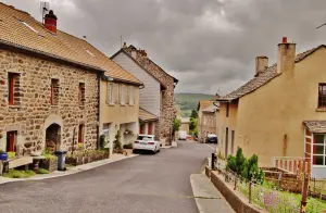
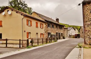
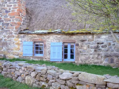
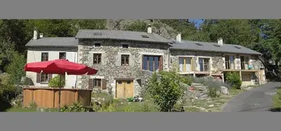
Full of charm, the village also reveals an important architectural heritage testifying to the rich past of this city of Haute-Loire.

Geographical information

MunicipalitySaint-Front
Postcode43550
Latitude44.9779310 (N 44° 58’ 41”)
Longitude4.1436719 (E 4° 8’ 37”)
AltitudeFrom 796m to 1594m
Surface area52.33 km²
Population411 inhabitants
Density7 inhabitants/km²
PrefectureLe Puy-en-Velay (26 km, 34 min)
Insee code43186
IntercommunalityCC Mézenc-Loire-Meygal
DepartmentHaute-Loire
TerritoriesAuvergne, Massif Central
RegionAuvergne-Rhône-Alps

Nearest cities & towns

Montusclat7.5 km (13 min)
Fay-sur-Lignon8.9 km (12 min)
Chaudeyrolles9.5 km (13 min)
Moudeyres12.1 km (17 min)
Champclause12.3 km (20 min)
Les Vastres13.5 km (18 min)
Freycenet-la-Tour13.8 km (16 min)
Les Estables14 km (17 min)
Lantriac14.6 km (19 min)
Laussonne16 km (17 min)
Saint-Clément16.7 km (23 min)
Saint-Julien-Chapteuil17.7 km (23 min)
Araules18.9 km (26 min)
Mazet-Saint-Voy19.3 km (24 min)

Things to see and do

Listed as a Historical Monument since the beginning of the 20th century, the church Saint-Front is a Romanesque building dating back to the 12th century. Entirely built in volcanic stones, it was built by the monks of Monastier. Outside, the portal was redone at the end of the 15th century, while the south aisle was remodeled in the 16th century. Its originality is to present a single comb tower on the plateau and a balcony whose stones come from the chartreuse of Bonnefoy.

Of volcanic origin, Lake Saint-Font is the highest in the department, extending over 1250 meters above sea level. Accessible by several hiking trails such as the GR 40 and 430, it has a measuring station since the late 2000s.

Do not miss the Souteyros waterfall which rises a few kilometers from the village. A trail from Souteyros allows to discover it.

While strolling in the commune, you will also be able to admire a cross of the sixteenth century of five meters high, an old rocker that used to weigh the animals during fairs, or the Bachat carved in a block of stone.

Five kilometers from the village, in Bigorre, it is possible to discover the ecomuseum. It is nestled in the heart of a charming village thatched cottages in stone covered with slate or thatch.

Places of interest

Monuments

Events and festivities

The festival of the Goat is organized every Sunday following July 14th. On the program, a garage sale or a country market.

Every Sunday after August 15th, place at the local festival and its animations.

Photos

The municipality
The municipality
See photo
The municipality
The municipality
See photo
Lake of Saint-Front (© JE)
See photo
Lake of Saint-Front
Lake of Saint-Front
See photo
Hamlet of Bigorre
Hamlet of Bigorre
See photo
Bigorre ecomuseum
Bigorre ecomuseum
See photo
Village of Saint-Front and its church
See photo
Village of Saint-Front
See photo
Mont Mézenc
Mont Mézenc
See photo
Lake of Saint-Front (© JE)
See photo
Lake of Saint-Front (© JE)
See photo
The town hall
The town hall
See photo
The municipality
The municipality
See photo
The municipality
The municipality
See photo
The municipality
The municipality
See photo
The municipality
The municipality
See photo
The municipality
The municipality
See photo
The War Memorial
The War Memorial
See photo
The municipality
The municipality
See photo
The church
The church
See photo
The church
The church
See photo

Weather

Saturday 20 april
Min. 0°C - Max. 5°C
Day
Night
Sunday 21 april
Min. -1°C - Max. 4°C
Day
Night
Monday 22 april
Min. -1°C - Max. 5°C
Day
Night

Visits, leisure and activities nearby

Leisure activities

Last nameActivity typeRateCity
Segway trip
Entertainment30 € Tence (19.1 km)
Visit to Lussas animal park
Entertainment7 € to 10 € Lussas (49 km)
Canyoning on the Ardèche
Sports sensations42 € to 70 € Sanilhac (50 km)

Outings

Last nameOuting typeDifficultyDurationDeparture municipality
Lizieux Peak
HikeIntermediate1:00Mazet-Saint-Voy (11.1 km)
The Factor Path
HikeEasy2:10Sainte-Eulalie (16.2 km)
Yssingeaux Pur Suc - Saint-Roch Hill
HikeEasy1:30Yssingeaux (18.4 km)
Greenway
HikeEasy3:00Brives-Charensac (18.6 km)
From Upper Vivarais to the Doux Valley
HikeAthletic10:00Saint-Agrève (20 km)

Restaurants

Bed & breakfasts

Vacation rentals

Campsites

Hotels

Your holidays
A hotel
A vacation rental
A bed & breakfast
A campsite
A leisure activity
A restaurant
A rental car
A plane ticket
By continuing to browse our site, you are agreeing to the use of cookies to improve your experience and make targeted offers.
Find out more and make settings
Your account