
Favourite
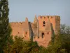
The fortified church of Simorre
| Municipality | Saint-Élix-d'Astarac |
|---|---|
| Postcode | 32450 |
| Latitude | 43.4932720 (N 43° 29’ 36”) |
| Longitude | 0.7752059 (E 0° 46’ 31”) |
| Altitude | From 177m to 291m |
| Surface area | 8.17 km² |
| Population | 189 inhabitants |
| Density | 23 inhabitants/km² |
| Prefecture | Auch (29 km, 36 min) |
| Insee code | 32374 |
| Intercommunality | CC des Coteaux Arrats Gimone |
| Department | Gers |
| Territories | Gascony, Midi-Pyrénées |
| Region | Occitanie |
| Pellefigue | 3.8 km (7 min) |
|---|---|
| Mongausy | 3.9 km (9 min) |
| Saint-Martin-Gimois | 5 km (12 min) |
| Sémézies-Cachan | 6.5 km (12 min) |
| Saramon | 6.6 km (9 min) |
| Simorre | 7 km (10 min) |
| Faget-Abbatial | 7.8 km (13 min) |
| Gaujac | 7.8 km (11 min) |
| Montamat | 8 km (15 min) |
| Boulaur | 9.3 km (13 min) |
| Villefranche-d'Astarac | 9.8 km (11 min) |
| Sauveterre | 9.8 km (15 min) |
| Lartigue | 9.9 km (16 min) |
| Saint-Soulan | 10.1 km (19 min) |
| Last name | Outing type | Difficulty | Duration | Departure municipality |
|---|---|---|---|---|
 | Hike | Intermediate | 3:25 | Castelnau-Barbarens (10 km) |
 | Hike | Easy | 35 min | Lombez (11.1 km) |
 | Hike | Easy | 2:30 | Bazian (41 km) |
 | Village visit | Intermediate | 2:00 | Carbonne (43 km) |
 | Hike | Intermediate | 3:00 | Bize (56 km) |