- Castle Etangsannes.
- Hiking tours 1001 Views Haute Serre and pond Pinaud.


Favourite


| Municipality | Saint-Chabrais |
|---|---|
| Postcode | 23130 |
| Latitude | 46.1325300 (N 46° 7’ 57”) |
| Longitude | 2.2052310 (E 2° 12’ 19”) |
| Altitude | From 389m to 542m |
| Surface area | 24.94 km² |
| Population | 297 inhabitants |
| Density | 11 inhabitants/km² |
| Prefecture | Guéret (35 km, 33 min) |
| Insee code | 23185 |
| Intercommunality | CC Marche et Combraille en Aquitaine |
| Department | Creuse |
| Territories | Limousin, Massif Central |
| Region | New-Aquitaine |
| Pierrefitte | 3.1 km (7 min) |
|---|---|
| Chénérailles | 4.3 km (6 min) |
| Saint-Dizier-la-Tour | 5.1 km (12 min) |
| Gouzougnat | 5.3 km (8 min) |
| Saint-Loup | 6 km (10 min) |
| Saint-Julien-le-Châtel | 6.3 km (13 min) |
| Peyrat-la-Nonière | 7.5 km (13 min) |
| Gouzon | 7.9 km (9 min) |
| Cressat | 10.7 km (11 min) |
| Saint-Pardoux-les-Cards | 10.9 km (13 min) |
| La Celle-sous-Gouzon | 11.9 km (15 min) |
| Issoudun-Létrieix | 12.1 km (16 min) |
| Le Chauchet | 12.7 km (20 min) |
| Trois-Fonds | 13.8 km (15 min) |
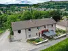
| Monuments | |
|---|---|
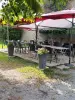
| Natural sites |
| Last name | Outing type | Difficulty | Duration | Departure municipality |
|---|---|---|---|---|
 | Car itinerary | Easy | 1:00 | Ahun (13.2 km) |
 | Hike | Easy | 2:00 | Chambon-sur-Voueize (18.1 km) |
 | Hike | Intermediate | 2:20 | Évaux-les-Bains (22 km) |
 | Hike | Easy | 2:00 | Évaux-les-Bains (22 km) |
 | Car itinerary | Easy | 1:35 | Évaux-les-Bains (22 km) |