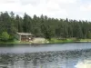
Located on the eastern flank of Livradois Mountains, the territory of the municipality of Saint-Bonnet-le-Chastel consists firstly of a portion of the valley of the Dolo, from its confluence with the stream of Chabrier to downstream of the mill of Losmeix, and also the valley of Beligeon. Today it is mostly wooded.
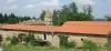
The population is divided between a small town, mentioned for the first time in the 10th century, about twenty villages (all of which existed in the Middle Ages) and a dozen hamlets or discrepancies.
The place-names are of the highest inhabited, west of Dolo Charraud (980 m), and, is the Bois-de-Coisse (1035 m). Followed Pavagnat (between 970 m and 990 m) and Montel (approx. 970 m). The villages with the lowest altitude are Losmeix (820 m) and Riodanges (830 m). The town of Saint-Bonnet stretches between him slightly less than 860 m and almost 915 m.
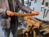
Agriculture still accounts for much of economic activity. The Company Fromagère Livradois, based in Fournols, collecting milk from farms in the four main town.
The place of tourism is also important. The town has numerous homes and several tourist accommodation.