
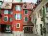


Favourite
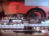
The EDF Electropolis Museum
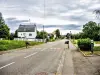


| Municipality | Saint-Bernard |
|---|---|
| Postcode | 68720 |
| Latitude | 47.6663349 (N 47° 39’ 59”) |
| Longitude | 7.2074110 (E 7° 12’ 27”) |
| Altitude | From 264m to 344m |
| Surface area | 6.04 km² |
| Population | 589 inhabitants |
| Density | 97 inhabitants/km² |
| Prefecture | Colmar (63 km, 46 min) |
| Insee code | 68081 |
| Intercommunality | CC Sundgau |
| Department | Haut-Rhin |
| Territory | Alsace |
| Region | Great East |
| Eglingen | 2.8 km (5 min) |
|---|---|
| Heidwiller | 3.7 km (6 min) |
| Spechbach | 3.9 km (9 min) |
| Balschwiller | 4.1 km (7 min) |
| Hagenbach | 4.9 km (8 min) |
| Aspach | 5.1 km (9 min) |
| Illfurth | 5.6 km (8 min) |
| Buethwiller | 5.8 km (10 min) |
| Galfingue | 6.2 km (11 min) |
| Froeningen | 6.6 km (10 min) |
| Gommersdorf | 7.3 km (11 min) |
| Carspach | 7.4 km (10 min) |
| Tagolsheim | 7.5 km (12 min) |
| Hochstatt | 8.5 km (12 min) |
| Last name | Activity type | Rate | City |
|---|---|---|---|
 | Culture and education | 11 € | Le Thillot (41 km) |
 | Culture and education | 6 € to 8 € | Labaroche (49 km) |
 | Arts and Crafts | 12 € | Basse-sur-le-Rupt (50 km) |
| Last name | Outing type | Difficulty | Duration | Departure municipality |
|---|---|---|---|---|
 | Hike | Intermediate | 1:00 | Burnhaupt-le-Haut (8.4 km) |
 | Hike | Intermediate | 1:05 | Thann (17.8 km) |
 | Village visit | Easy | 1:00 | Masevaux-Niederbruck (19.8 km) |
 | Hike | Intermediate | 3:00 | Masevaux-Niederbruck (20 km) |
 | Hike | Intermediate | 2:30 | Kirchberg (24 km) |