Saint-André-de-Valborgne is a commune of the Gard, in the Occitanie region, 50 km west of Ales.
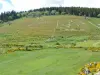
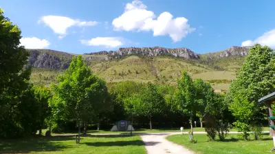
The territory of the vast locality of 48 km² is crossed by the course of Gardon and belongs to the natural region of the Cevennes. Located in the foothills of Mount Aigoual, the locality is bordering the Lozère and culminates at 1200 m above sea level but the village itself is below the steepest slopes.
Saint-André-de-Valborgne is occupied from the early Middle Ages by monks clearers who establish the culture of chestnut. The parish is then shaken like the whole region by the Cathar troubles and then by the wars of Religion. In the early eighteenth century, it is affected by the revolt of the Camisards.
The village consisting of a village and many hamlets and scattered farms was in the twentieth century very affected by the rural exodus. There are only about 420 inhabitants against more than 1500 in the aftermath of the First World War.
In addition to agricultural activity (chestnut groves, cereals) and pastoralism (sheep and goat farming), there is now a tourist vocation linked to the preserved historical and natural heritage of the town. A step that will be popular with hikers and green tourism.
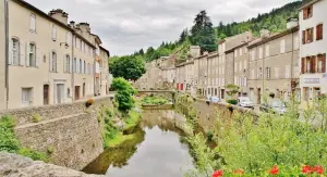
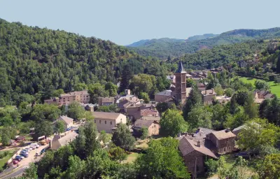
Typically Cevennes, the village of Saint-André-de-Valborgne as such, with its narrow streets lined with old houses, its heritage, its traditional square in front of the church, decorated with a fountain, is a postcard.
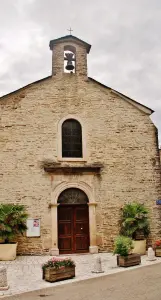
In detail, a heritage discovery includes the parish church, Romanesque style, dating back to its oldest parts of the thirteenth and fourteenth centuries. Its plan is simple, with a single nave, an apse and ogival chapels, but we will appreciate the materials (shale pebbles). The church has been recently renovated.
The town also has a temple, which dates from the nineteenth century, which reflects the strong vitality of the Protestant community in the Cevennes.
In the village always, the fountain of the Griffon, the Old Bridge on the Gardon and the tower of the Clock with a wrought iron campanile add to the authenticity of the places and the charm experienced by the visitor.
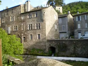
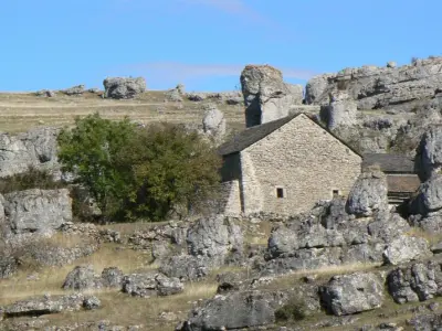
As for the tormented past of the town, he initiated the construction of several castles and strongholds that punctuate the territory, defensive, serving as refuges peasants. They were erected for the most part in the twelfth or thirteenth centuries like the castle of Fare, now in ruins, the castle of Folhaquier and that said Barbuts or Mas Voyer. Nogaret Castle was rebuilt in the 17th century. Often overhauled, they have become more residential over time.
They will mark with interest many hikes whose routes also borrow areas devoted to pastoralism or areas of the mountain. It is advisable to inquire about the difficulties of certain circuits. Some routes follow mule tracks or follow the banks of the Gardon and rivers descending from the nearby peaks. Note that for walkers, an interpretive trail with signs has been developed to discover the village and its surrounding area in a fun and friendly way. Brochures and information on +33 (0) 4 66 60 32 11.
Hikers' paradise, Saint-André-de-Valborgne is also that of fishermen (including trout lovers). Learn about the regulations on +33 (0) 4 66 02 91 61.
Finally, we will be pleased to attend shows and evenings telling stories including the revolt of Camisards programmed at the cultural space Bernadette Lafont. Information on +33 4 66 60 30 08.


")