

Favourite
The Circuit of Remembrance
| Municipality | Rocquencourt |
|---|---|
| Postcode | 60120 |
| Latitude | 49.6498050 (N 49° 38’ 59”) |
| Longitude | 2.4162890 (E 2° 24’ 59”) |
| Altitude | From 81m to 151m |
| Surface area | 9.81 km² |
| Population | 196 inhabitants |
| Density | 19 inhabitants/km² |
| Prefecture | Beauvais (39 km, 42 min) |
| Insee code | 60544 |
| Intercommunality | CC de l'Oise Picarde |
| Department | Oise |
| Territory | Picardy |
| Region | Hauts-de-France |
| Sérévillers | 2.3 km (4 min) |
|---|---|
| Coullemelle | 2.5 km (5 min) |
| Le Mesnil-Saint-Firmin | 2.7 km (6 min) |
| Villers-Tournelle | 3.6 km (9 min) |
| Broyes | 5 km (8 min) |
| Quiry-le-Sec | 5.4 km (9 min) |
| Plainville | 5.4 km (10 min) |
| Bacouël | 5.5 km (8 min) |
| Rouvroy-les-Merles | 5.7 km (12 min) |
| Esclainvillers | 6 km (10 min) |
| Tartigny | 6.7 km (9 min) |
| Folleville | 6.9 km (11 min) |
| Grivesnes | 7.2 km (13 min) |
| Le Cardonnois | 7.2 km (11 min) |
| Last name | Activity type | Rate | City |
|---|---|---|---|
 | Culture and education | 10 € to 450 € | Lassigny (31 km) |
 | Culture and education | 7 € | Compiègne (39 km) |
| Last name | Outing type | Difficulty | Duration | Departure municipality |
|---|---|---|---|---|
 | Hike | Easy | 2:00 | Paillart (5.1 km) |
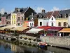
 | Village visit | Easy | 1:00 | Blangy-Tronville (26 km) |
 | Cycling itinerary | Easy | 3:00 | Blangy-Tronville (26 km) |
| Hike | Easy | 3:00 | Courcelles-sous-Moyencourt (32 km) |
| Hike | Intermediate | 4:00 | Courcelles-sous-Moyencourt (32 km) |