

Favourite
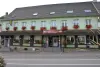
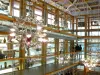
La Grande Place, Saint-Louis Crystal Museum
| Municipality | Richeling |
|---|---|
| Postcode | 57510 |
| Latitude | 49.0291930 (N 49° 1’ 45”) |
| Longitude | 6.9604290 (E 6° 57’ 38”) |
| Altitude | From 217m to 264m |
| Surface area | 4.21 km² |
| Population | 358 inhabitants |
| Density | 85 inhabitants/km² |
| Prefecture | Metz (68 km, 46 min) |
| Insee code | 57581 |
| Intercommunality | CA Sarreguemines Confluences |
| Department | Moselle |
| Territory | Lorraine |
| Region | Great East |
| Rémering-lès-Puttelange | 1.7 km (3 min) |
|---|---|
| Holving | 2.3 km (4 min) |
| Puttelange-aux-Lacs | 3.5 km (4 min) |
| Grundviller | 4 km (7 min) |
| Hilsprich | 5.5 km (7 min) |
| Sarralbe | 6.7 km (8 min) |
| Ernestviller | 6.8 km (8 min) |
| Loupershouse | 7.5 km (9 min) |
| Saint-Jean-Rohrbach | 7.6 km (7 min) |
| Guebenhouse | 7.7 km (11 min) |
| Hoste | 7.9 km (9 min) |
| Woustviller | 8.3 km (10 min) |
| Farschviller | 9.1 km (12 min) |
| Kappelkinger | 9.5 km (15 min) |
| Last name | Outing type | Difficulty | Duration | Departure municipality |
|---|---|---|---|---|
 | Cycling itinerary | Easy | 4:30 | Frauenberg (17.1 km) |
| Cycling itinerary | Easy | 4:00 | Lorentzen (17.9 km) |
| Hike | Easy | 2:00 | Diemeringen (19.3 km) |
 | Hike | Easy | 30 min | Ham-sous-Varsberg (28 km) |
 | Hike | Athletic | 4:20 | Zittersheim (32 km) |