


Favourite
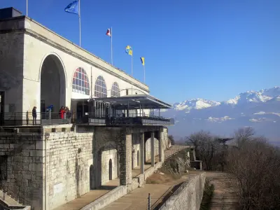
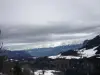
La Bastille fort
| Municipality | Quaix-en-Chartreuse |
|---|---|
| Postcode | 38950 |
| Latitude | 45.2529309 (N 45° 15’ 11”) |
| Longitude | 5.7187180 (E 5° 43’ 7”) |
| Altitude | From 270m to 1689m |
| Surface area | 18.09 km² |
| Population | 934 inhabitants |
| Density | 51 inhabitants/km² |
| Prefecture | Grenoble (12.1 km, 19 min) |
| Insee code | 38328 |
| Intercommunality | ME Grenoble-Alpes-Métropole |
| Department | Isère |
| Territories | Alps, Dauphiné |
| Region | Auvergne-Rhône-Alps |
| Proveysieux | 6.1 km (11 min) |
|---|---|
| Saint-Égrève | 6.7 km (12 min) |
| Fontanil-Cornillon | 8.1 km (16 min) |
| Sarcenas | 8.8 km (17 min) |
| Grenoble | 9.9 km (18 min) |
| Saint-Martin-le-Vinoux | 10 km (19 min) |
| Corenc | 11.2 km (19 min) |
| Le Sappey-en-Chartreuse | 11.3 km (18 min) |
| Sassenage | 12.6 km (22 min) |
| Fontaine | 12.8 km (21 min) |
| Mont-Saint-Martin | 13.5 km (27 min) |
| Seyssinet-Pariset | 13.7 km (21 min) |
| Montbonnot-Saint-Martin | 14 km (26 min) |
| La Tronche | 14.2 km (25 min) |
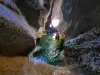
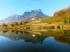
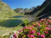
| Natural sites |
|---|
| Last name | Activity type | Rate | City |
|---|---|---|---|
 | Sports sensations | 48 € to 60 € | Grenoble (6.5 km) |
 | Sports sensations | 50 € to 65 € | Grenoble (6.7 km) |
 | Sports sensations | 50 € to 80 € | Grenoble (7.2 km) |
 | Sports sensations | 45 € to 75 € | Autrans-Méaudre en Vercors (16.3 km) |
 | Local flavours | 38 € to 120 € | Porte-de-Savoie (35 km) |
| Last name | Outing type | Difficulty | Duration | Departure municipality |
|---|---|---|---|---|
 | Hike | Intermediate | 4:00 | Lans-en-Vercors (13.2 km) |
 | Hike | Intermediate | 1:30 | Chamrousse (19.6 km) |
 | Hike | Intermediate | 2:00 | Vizille (20 km) |
 | Hike | Easy | 2:30 | Saint-Pierre-d'Entremont (21 km) |
 | Hike | Athletic | 3:00 | Livet-et-Gavet (23 km) |


