Liven up your holidays!

Peyrignac

Tourism, holidays & weekends guide in the Dordogne

Peyrignac - Tourism, holidays & weekends guide in the Dordogne
8.5
2

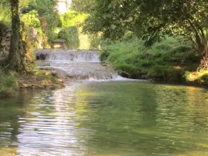
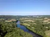
The town is located on the southwest slope of a hill that ends on the left bank of the Sern by a series of slopes sometimes fast, but mostly quite mild. Small streams flow on the territory of Peyrignac in the North-South direction, forming verdant small valleys that break the monotony of the landscape.

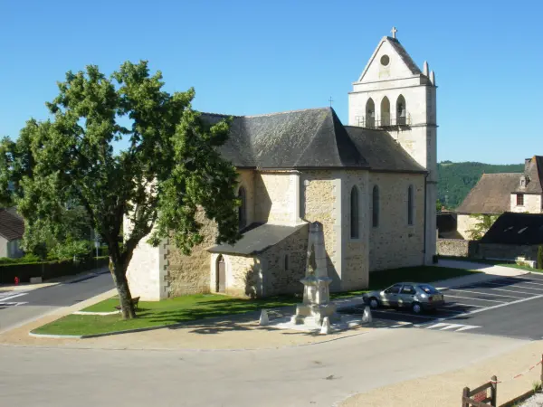
The town is beautifully outlined on a background of beautiful meadows that surround it and that make it like a green carpet; the school, the slender spiers of the towers of the castle of La Chapoulie and a whole enclosure of 'Puys' give it an original character that does not lack charm.

Peyrignac is located 5 minutes from the motorway interchange of La Bachellerie, which allows to go to Perigueux and Brive-la-Gaillarde in 15 minutes.

Tourist sites are about 20 to 30 minutes (Lascaux, Toutoirac, Hautefort...).

Geographical information

MunicipalityPeyrignac
Postcode24210
Latitude45.1574550 (N 45° 9’ 27”)
Longitude1.1918480 (E 1° 11’ 31”)
AltitudeFrom 107m to 308m
Surface area6.30 km²
Population583 inhabitants
Density92 inhabitants/km²
PrefecturePérigueux (50 km, 34 min)
Insee code24324
IntercommunalityCC Terrassonnais Haut Périgord Noir
DepartmentDordogne
TerritoriesAquitaine, Périgord
RegionNew-Aquitaine

Nearest cities & towns

La Bachellerie4.3 km (9 min)
Châtres4.4 km (8 min)
Saint-Rabier6 km (8 min)
Azerat6.9 km (9 min)
Le Lardin-Saint-Lazare7.7 km (10 min)
Condat-sur-Vézère9.2 km (12 min)
Les Farges9.3 km (12 min)
Villac9.6 km (18 min)
Badefols-d'Ans9.7 km (15 min)
Beauregard-de-Terrasson10.6 km (13 min)
La Chapelle-Saint-Jean10.8 km (16 min)
Auriac-du-Périgord11.4 km (16 min)
Thenon11.5 km (14 min)
Granges-d'Ans12.4 km (14 min)

Things to see and do

The church was built on the site of a very old chapel. The gate and a wall section of the old chapel have been preserved in the current facade.

The castle of La Chapoulie consists of two towers dating from the fifteenth century. It is assumed that they were built by the English. These towers are twin, one much bigger than the other; the thinnest, which is the highest, is entirely occupied by a remarkable staircase all in stone. The little door of this tower was once the only entrance, it was defended by a portcullis whose hinges still exist. These two towers were equipped with loopholes.

The Bardes fountain: it is located near La Chapoulie and recalls the Celtic poets who sang the heroes.

Watercourse: Taravelou

Places of interest

Monuments

Events and festivities

Every Friday in July and August: farmers market in the school yard from 18h.

The last weekend of August: votive festival, flea market, petanque contest.

Photos

The church
The church
See photo
Taravelou
Taravelou
See photo
The renovated washhouse
See photo
The town hall
The town hall
See photo
Rural multiple
Rural multiple
See photo
The place Bonnelle at the entrance of the village
See photo

Weather

Wednesday 24 april
Min. 0°C - Max. 13°C
Day
Night
Thursday 25 april
Min. 6°C - Max. 14°C
Day
Night
Friday 26 april
Min. 7°C - Max. 16°C
Day
Night

Visits, leisure and activities nearby

Multiple hiking circuits on the town and surrounding villages.

Tourist sites in about 30 minutes: Lascaux, Tourtoirac Caves, Hautefort Castle, Beynac, Sarlat...

Leisure activities

Last nameActivity typeRateCity
Electric mountain bike hire
Sports sensations45 € Excideuil (23 km)
Comille Aventure treetop adventure park
Sports sensations20 € Cornille (33 km)
Visit to an artist's studio - Sculpture and art foundry
Arts and CraftsFreePechs-de-l'Espérance (35 km)
Hot air balloon flight over Périgord
Nature and the great outdoors130 € to 215 € Saint-Vincent-de-Cosse (36 km)
Canoe or kayak hire in the Dordogne
Sports sensations15 € to 25 € Carsac-Aillac (36 km)

Outings

Last nameOuting typeDifficultyDurationDeparture municipality
Red sandstone
HikeEasy1:15Vars-sur-Roseix (17.6 km)
Boucle of Rouffignac
Mountain bike itineraryEasy1:00Rouffignac-Saint-Cernin-de-Reilhac (21 km)
From Saint-Mesmin to the Savignac-Lédrier forges
HikeEasy4:00Saint-Mesmin (22 km)
The vineyards
HikeIntermediate3:00Concèze (25 km)
Saint-Michel d'Auberoche Chapel
HikeIntermediate4:00Antonne-et-Trigonant (29 km)

Restaurants

Bed & breakfasts

Vacation rentals

Campsites

Hotels

Your holidays
A hotel
A vacation rental
A bed & breakfast
A campsite
A leisure activity
A restaurant
A rental car
A plane ticket
By continuing to browse our site, you are agreeing to the use of cookies to improve your experience and make targeted offers.
Find out more and make settings
Your account