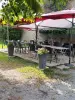
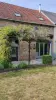
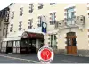
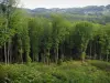
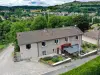
The name of the town means "standing stones", there was chaos in the town was cut granite pavers in about 1938. Many clusters are present in the forest of Chabrières.

Favourite


The name of the town means "standing stones", there was chaos in the town was cut granite pavers in about 1938. Many clusters are present in the forest of Chabrières.
| Municipality | Peyrabout |
|---|---|
| Postcode | 23000 |
| Latitude | 46.1071860 (N 46° 6’ 26”) |
| Longitude | 1.9127030 (E 1° 54’ 46”) |
| Altitude | From 446m to 685m |
| Surface area | 8.91 km² |
| Population | 158 inhabitants |
| Density | 17 inhabitants/km² |
| Prefecture | Guéret (11.2 km, 15 min) |
| Insee code | 23150 |
| Intercommunality | CA du Grand Guéret |
| Department | Creuse |
| Territories | Limousin, Massif Central |
| Region | New-Aquitaine |
| Savennes | 2.3 km (4 min) |
|---|---|
| Saint-Yrieix-les-Bois | 3 km (6 min) |
| Lépinas | 4.5 km (7 min) |
| Sainte-Feyre | 5 km (8 min) |
| Saint-Christophe | 5.1 km (9 min) |
| La Saunière | 6.9 km (10 min) |
| La Chapelle-Taillefert | 7.1 km (13 min) |
| Maisonnisses | 7.2 km (10 min) |
| Saint-Hilaire-la-Plaine | 7.9 km (13 min) |
| Mazeirat | 9.9 km (16 min) |
| Sardent | 10.1 km (16 min) |
| Saint-Victor-en-Marche | 10.1 km (15 min) |
| Saint-Laurent | 10.3 km (14 min) |
| Sous-Parsat | 10.4 km (17 min) |
| Last name | Outing type | Difficulty | Duration | Departure municipality |
|---|---|---|---|---|
 | Car itinerary | Easy | 1:00 | Ahun (10.5 km) |
 | Village visit | Easy | 3:00 | Soubrebost (17.5 km) |
 | Hike | Easy | 1:30 | Bourganeuf (21 km) |
 | Hike | Easy | 3:00 | Moutier-Malcard (32 km) |
 | Village visit | Athletic | 6:00 | Peyrat-le-Château (34 km) |