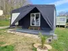


Favourite
Nogent-le-Rotrou
| Municipality | Montlandon |
|---|---|
| Postcode | 28240 |
| Latitude | 48.3913660 (N 48° 23’ 29”) |
| Longitude | 1.0230360 (E 1° 1’ 23”) |
| Altitude | From 225m to 283m |
| Surface area | 2.87 km² |
| Population | 260 inhabitants |
| Density | 90 inhabitants/km² |
| Prefecture | Chartres (37 km, 36 min) |
| Insee code | 28265 |
| Intercommunality | CC Terres de Perche |
| Department | Eure-et-Loir |
| Territory | Perche |
| Region | Centre-Loire Valley |
| Montireau | 2.2 km (4 min) |
|---|---|
| Champrond-en-Gâtine | 4 km (3 min) |
| Saintigny | 6.5 km (11 min) |
| Saint-Victor-de-Buthon | 8.4 km (8 min) |
| Le Thieulin | 8.9 km (10 min) |
| Marolles-les-Buis | 9.5 km (13 min) |
| Friaize | 10.3 km (10 min) |
| Thiron-Gardais | 11 km (15 min) |
| Les Corvées-les-Yys | 11.3 km (12 min) |
| Saint-Éliph | 11.3 km (10 min) |
| Vaupillon | 11.9 km (16 min) |
| Saint-Denis-des-Puits | 12.3 km (17 min) |
| Combres | 13.1 km (10 min) |
| Sablons sur Huisne | 14.1 km (13 min) |
| Last name | Activity type | Rate | City |
|---|---|---|---|
 | Sports sensations | 22 € to 75 € | Fontaine-Simon (13.4 km) |
| Last name | Outing type | Difficulty | Duration | Departure municipality |
|---|---|---|---|---|
 | Hike | Intermediate | 2:45 | Nonvilliers-Grandhoux (11.9 km) |
 | Village visit | Easy | 1:00 | Châteaudun (42 km) |
 | Hike | Easy | 3:00 | Châteaudun (42 km) |
 | Hike | Easy | 3:25 | Saint-Longis (49 km) |
 | Hike | Easy | 55 min | Bonnétable (51 km) |