

Favourite
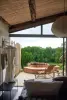
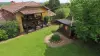
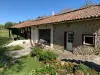
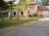
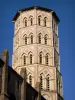
Lombez Cathedral
| Municipality | Montamat |
|---|---|
| Postcode | 32220 |
| Latitude | 43.4858410 (N 43° 29’ 9”) |
| Longitude | 0.8440470 (E 0° 50’ 39”) |
| Altitude | From 185m to 306m |
| Surface area | 6.60 km² |
| Population | 117 inhabitants |
| Density | 17 inhabitants/km² |
| Prefecture | Auch (36 km, 39 min) |
| Insee code | 32277 |
| Intercommunality | CC du Saves |
| Department | Gers |
| Territories | Gascony, Midi-Pyrénées |
| Region | Occitanie |
| Gaujac | 2.6 km (4 min) |
|---|---|
| Mongausy | 4.4 km (7 min) |
| Sauveterre | 5 km (12 min) |
| Saint-Soulan | 5 km (11 min) |
| Lombez | 6.5 km (11 min) |
| Saint-Martin-Gimois | 6.7 km (11 min) |
| Polastron | 7 km (15 min) |
| Pellefigue | 7 km (11 min) |
| Saint-Élix-d'Astarac | 8 km (15 min) |
| Saramon | 8.4 km (10 min) |
| Sabaillan | 9.5 km (16 min) |
| Samatan | 9.7 km (14 min) |
| Puylausic | 10.8 km (18 min) |
| Boulaur | 11.3 km (16 min) |
| Last name | Outing type | Difficulty | Duration | Departure municipality |
|---|---|---|---|---|
 | Hike | Easy | 35 min | Lombez (5.5 km) |
 | Hike | Intermediate | 3:25 | Castelnau-Barbarens (13.9 km) |
 | Village visit | Intermediate | 2:00 | Carbonne (37 km) |
 | Hike | Easy | 2:30 | Bazian (47 km) |
 | Hike | Intermediate | 3:00 | Bize (58 km) |