


Favourite
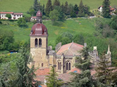
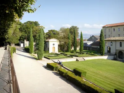
Saint-Antoine-l'Abbaye


| Municipality | Montagne |
|---|---|
| Postcode | 38160 |
| Latitude | 45.1416990 (N 45° 8’ 30”) |
| Longitude | 5.1928050 (E 5° 11’ 34”) |
| Altitude | From 259m to 560m |
| Surface area | 8.78 km² |
| Population | 276 inhabitants |
| Density | 31 inhabitants/km² |
| Prefecture | Grenoble (75 km, 55 min) |
| Insee code | 38245 |
| Intercommunality | CC Saint-Marcellin Vercors Isère Communauté |
| Department | Isère |
| Territories | Alps, Dauphiné |
| Region | Auvergne-Rhône-Alps |
| Saint Antoine l'Abbaye | 6.5 km (11 min) |
|---|---|
| Saint-Bonnet-de-Chavagne | 6.9 km (11 min) |
| Parnans | 7 km (11 min) |
| Saint-Lattier | 7.6 km (12 min) |
| Montmiral | 7.8 km (11 min) |
| Châtillon-Saint-Jean | 9.2 km (13 min) |
| Eymeux | 9.6 km (17 min) |
| Triors | 10 km (16 min) |
| Saint-Michel-sur-Savasse | 10.3 km (14 min) |
| Chatte | 10.9 km (18 min) |
| Saint-Paul-lès-Romans | 11.8 km (18 min) |
| Saint-Hilaire-du-Rosier | 12.2 km (17 min) |
| Génissieux | 12.9 km (19 min) |
| Le Chalon | 14.2 km (21 min) |


| Last name | Activity type | Rate | City |
|---|---|---|---|
 | Culture and education | 17 € | Pont-en-Royans (14.9 km) |
 | Sports sensations | 45 € to 75 € | Autrans-Méaudre en Vercors (28 km) |
 | Local flavours | Free | Eclassan (34 km) |
 | Nature and the great outdoors | 30 € to 305 € | Flachères (38 km) |
 | Entertainment | 130 € to 240 € | Saint-Jean-de-Bournay (40 km) |
| Last name | Outing type | Difficulty | Duration | Departure municipality |
|---|---|---|---|---|
 | Hike | Intermediate | 9:00 | Saint-Nazaire-en-Royans (10 km) |
 | Hike | Intermediate | 3:00 | Saint-Donat-sur-l'Herbasse (16.4 km) |
 | Cycling itinerary | Intermediate | 2:15 | Beaurepaire (24 km) |
 | Hike | Easy | 2:00 | La Chapelle-en-Vercors (26 km) |
 | Village visit | Easy | 1:00 | Corrençon-en-Vercors (29 km) |


