Monsireigne is in the upper grove, with a hilly, wooded despite consolidation. The Mill of the zipper is the culmination of Monsireigne "only windmill still standing, witnessed a flourishing past the mill.
The basement is composed of diorite (the stone quarries that extract the Meilleraie-Tillay). The agricultural life on the plateau, is intense, she is forced to occur despite the poor quality of some soils.
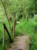
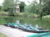
Many rivers flow through the valleys. Mention the Great Lay takes its source in Saint-Pierre-du-path for running up the Pivot-sur-Mer, the Chantefoin. The Big Lay gives us a beautiful landscape while digging a valley along its path, this valley shaped over time by an ancient glacier.
River: The Great Lay, the Chantefoin the Keys.
Villages Important: Chantefoin, Le Coudray, La Louraie.
Area of the town: 2050 hectares.
Climax: The mill of the zipper (129 m).
Wooded area: 126 hectares.
Towns bordering Saint-Prouant, Sigournais, Chavagnes-the-Redoux.
Town road: 43 km 16 km of logging roads in association property.
Agriculture: 18 seats operating. Average of 60 ha.
Regrouping: 89% of the arable land in 1972 (1,600 ha).
The town covers a plateau occupying the entire angle of the Lay, when changing direction, it falls sharply to the south. The banks of the river are steep and picturesque as the Roche Batiot. The stream of Keys and south than east Chantefoin limit the town.